On this New Year’s Eve, we (Rachel & Roger) recognize that we are WAY overdue for an update! Our apologies for being so remiss – it has been a rollercoaster of a year for us, in terms of racing, big professional and personal moves, and of course in regards to our family organization, the Alliance for International Reforestation (AIR). Looking back, we have so much to be grateful for. A few highlights:
1. Moving to Colorado! In April, we made the big move to make our permanent home base in the Rocky Mountains of western CO. With over 22 million acres of public lands and four national parks (Rocky Mt NP, Mesa Verde, Great Sand Dunes, and Black Canyon of the Gunnison), this state is an outdoor lover – and trail runner’s! – paradise, and we are having a blast exploring it.
2. New business! Because a new state and new home isn’t enough, Rachel decided to take the entrepreneurial plunge to start a business along with her colleague.WFH is the best.
3. Race bullet highlights:
WIN by Roger at Cayuga Trails 25 miler: Roger was back and forth for the lead, before making a move on a hill about halfway through, moving into 1st, and holding off a hard-charging 2nd place for the W.
3rd by Rachel at the Pikes Peak Ultra 50K: Rachel was in 3rd up until the halfway point, when she was passed on a long downhill by a super strong Melissa Brizic. She rallied until the very end, passing Melissa in the last mile and finishing a minute behind 2nd.
10th by Rachel at the Rio del Lago 100 miler: In her first 100 miler, Rachel got off to a rough start with a wrong turn early on, costing her 2+ miles and several places. With the support of a killer crew (Roger, her dad!, Anna and Shawn Olsen, and Martin Kurian), she passed several women, got into top-10 by mile 78, and held it to the end, finishing in just over 23 hours.
4. Biggest year yet for AIR! With the support of our incredible AIR family, this was our biggest fundraising year yet. THANK YOU all for your support – and as a reminder, each dollar goes to planting trees in communities that need them throughout Central America. We also filmed a documentary in partnership with Amalgamation Pictures, who captured beautifully the work that we do to reforest farmland, and empower indigenous women and communities through our work.
As we reflect back with so much gratitude, we hope to inspire you to do the same! What are you grateful for in 2019, and what excites you about the year ahead? Tell us below!
I have no idea how March has already come and gone – it’s been a whirlwind 2019 so far with lots of work activity, an upcoming move and massive career shift, and of course, ultra season is in full swing!
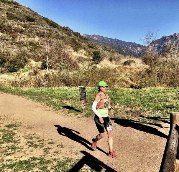
All of this is also a long-winded way of saying that I am woefully late in posting my first race report of the season, from the Marin Ultra Challenge 50K, held on March 9 in the gorgeous and iconic Marin Headlands, just north of San Francisco.
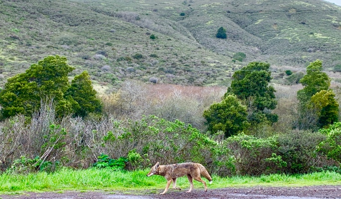
The Marin Headlands is part of a larger system of protected land that comprise the Golden Gate National Recreation Area (GGNRA), which was established by Congress in 1972 with the progressive and forward-thinking aim of offering an urban population the opportunity to experience and enjoy diverse protected plant and animal life normally found only in larger national parks. (It is fairly normal, for instance, to see coyotes like the one featured above casually sauntering along the roadways in the headlands, uncaring of the passing traffic or excited pointing and exclamations of visitors. It is, after all, their territory). All-in-all, the headlands is a gorgeous area characterized by rolling foothills and mountains with sweeping vistas of San Francisco, the Bay, and the Pacific. Not surprisingly, its miles of undulating trails are also incredibly popular with trail runners and mountain bikers.
For runners, the trails are as tough as they are beautiful, all steep ups and downs, with virtually no flat sections.
Lining up at the start, thinking about all the steep terrain, I knew this was going to be a tough race.
Over 6200 feet of elevation gain in a little over 30 miles. The course profile looked like teeth a great white would envy.
They counted us down, and blew the horn to send us off.
It started to pour.
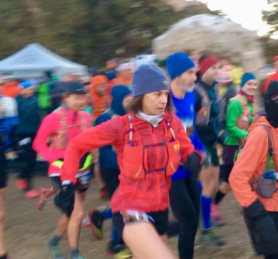
Not surprisingly, we started off with a climb – about 2 miles straight uphill. I started off alongside the inspiring rockstar Katie Arnold, a professional ultrarunner and author who won the competitive and tough Leadville 100 miler in Colorado last year.
At the start! Still relatively fresh and warm.
We stayed together for only a little while before Katie took off – I didn’t see her the rest of the race.
From miles 2 -10-ish, I remember little except a series of up-up-ouch-up followed by steepfastdownhills. Because of the rain and cold, I wasn’t sweating that much, and so I opted to not stop at the first aid station, waiting until the next aid station at Tennessee Valley before grabbing a gel and some sports drink. From there, we got a bit of respite from the climbs as we headed to Muir Beach, before hitting another wall straight up at mile 14. Here, we did a quick out and back, before returning back to Muir Beach around mile 20.
At this point I made the mistake of taking a quick nature break at the aid station.
Apparently at this time 2 women passed me (unbeknownst to me at the time).
I spent less then 2 minutes at the aid station before heading back out – and up! – another steep climb. I was admittedly getting tired by this point – my hands and legs were numb, and I was feeling like I was on the verge of bonking (i.e., running completely out of energy). At this point, Ashley Hall – a badass runner from Reno, NV – caught up with me on the climb. We chatted for a bit, and it was nice to share some miles with a friendly face. Nevertheless, as the climbs continued, I could feel myself starting to fade. I waved her on.
The race took us on a proper tour of the Marin Headlands!
From mile 24 on, it was just a slow grind, with me trying to gut it out as much as possible and maintain my position. There was one last, final climb before the finish that was the steepest of the day and just mean. Remarkably, I caught one woman who had passed me, and I continued on; when I got to the top, I saw that I was gaining on another woman! I let it out on the downhill mile into the finish, trying to make up as much ground as I could. I was closing on her, but simply ran out of room…
I ended up finishing 4th in 5:00:55, less than 20 seconds behind 3rd.
In spite of missing out on the podium, I could not be disappointed with the results: on what has been my hilliest 50K by far, I managed to PR by 20 minutes.
Plus, Roger was there with me, cheering me in, and even took me out to a massive, greasy diner breakfast at a local dive afterwards.
After an *amazing* experience at the Kodiak 50 miler in August, I was definitely eager to try my hand at another 50 mile race – and maybe, just maybe rack up a few more UTMB points in the process. With that said, the rest of the year was already shaping up to be travel-heavy for my work, and so I needed to find a race that was (relatively) local and not require any cross-country flights.
After scouring UltraSignup for possibilities, I found one that seemed to fit the bill: The Run the Rock 50 miler on November 10 at Smith Rock State Park, Oregon. It looked like a beautiful course of two x 25 mile loops through the park, and was a perfect excuse for Roger and I to visit the Pacific Northwest – something we’ve been wanting to do since moving out to California 3+ years ago! I was feeling strong coming off Kodiak, and looking forward to this next fun event.
The weeks leading up to the race were, naturally, hectic for work, and read like tour dates for an overly ambitious pop star: from October 26-28 I was in N.J.; from October 31 – Nov 2 I was in L.A.; from Nov 5 – 7 I was in Philly. I did my best to get in taper runs around 4am on hotel treadmills ahead of 14+ hour research days during my time on the road. On November 7, I flew back from Philly to San Francisco. The next day, Roger and I packed up and began the 9 hour drive up to Oregon.
On the way, we passed by the now-infamous Camp Fire that was raging just north of Sacramento. Being on I-5, we were several miles east of it, but could still see the hillsides burning – an incredibly eerie and sinister sight at night, underscored by our knowledge of devastating impact of the fire. Our heartfelt condolences go out to all those who have been affected, and our immense gratitude goes out to the firefighters who have been battling these blazes day and night. If anything, the fire – the severity of which many government officials and scientists have linked to climate change – has also brought home the importance of the work that our family does on behalf of the Alliance for International Reforestation (AIR) to plant trees and curtail the effects of climate change (for those who may not know, AIR is this blog’s namesake and the organization that we are proud to represent in our races).
We arrived in Oregon safe and sound, and after picking up my number we turned in for the night to get as much rest as possible ahead of what was sure to be a long day.
The morning of Saturday, November 10 – race day – was freezing. Literally. The temperature gauge on our Prius read 19 degrees as we drove to the start line. We knew it would be cold, and had packed the requisite cold weather gear, but I was still nervous: I had not been training in these types of conditions, and knew that in the cold, the body often requires significantly more energy just to keep itself warm – in addition, of course, to the energy required to run 50 miles in the mountains.
With that said, I did my best to get in a good ‘warm up’ (in the loosest sense of the term), and toed the line. I knew it would be a fast, competitive race as there were a few pros in the mix. The announcer counted down and sent us off! I put my head down and committed to running strong, having fun, and enjoying the experience.
Taking off at the start. Super serious because I was super cold and focusing on not getting hypothermic.
The first 4 miles took us down from the rim of a canyon to a riverbed that skirted the edge of the picturesque and eponymous rock for which the park is named. This first section was relatively flat and fast, and I just focused on finding a comfortable pace and enjoying the sunrise hitting the rock, turning it varying shades of gold, pink, and rose.
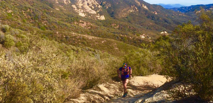
The next 6 miles were a long, steady climb up said rock – back and forth across SO MANY switchbacks that afforded us unobstructed views of Mt. Hood and Mt. Jefferson, which were stunning in the early morning light. On this section, I focused again on keeping a steady effort, and ended up passing the super strong Rachel Entrekin on the switchbacks, at this point running in second.
After the climb, the next few miles offered a fun run along the ridgeline before a fast descent down a fire road, and then a turn onto undulating trails that twisted and turned through canyons before taking a turn back up to the ridgeline and aid station, around mile 21. Just before the aid station, I was joined by La Sportiva athlete Maria Dalzot and Corinne Saylor, and we ran together for the rest of the first lap.
After a fast and steep descent, we arrived back at the start/finish line more or less together at around 4 hours – much faster than my previous 50 miler (although to be fair, the Kodiak 50 miler was at altitude and had about 2,000 more feet of elevation gain).
At this point in the race, with the mid-morning sun overhead I was warm enough to take off my jacket and pass it off to Roger – who was a total champ in crewing for me on such a cold day!
Maria and Corinne, who ran in with me, ended up leaving the start/finish seconds before I did – so I left out of there in 4th, on my own. This ended up being a drawback, as literally hundred of meters after leaving I got turned around by ‘detour’ signs on the trail. These signs were printed in similar font as the race signs, and so I followed them for a ways before realizing that something was off. I turned back to retrace my steps and found the race route, but this detour ended up costing me a few minutes. At the time, I did not realize how much this would affect my race, but 2nd – 6th woman all ended up finishing within 9 minutes of each other – which is very close and rare for a 50 mile race!
The second lap was definitely tough. I was wondering if I had been overly optimistic in getting rid of my jacket, because there were many sections where we were running in the shadows and I was definitely getting cold in them. I also think my body was requiring a bit more fuel to stay warm, and around mile 30 I was starting to experience some early signs of bonking, so I made sure to fuel up well at the next aid station.
Somewhere along the way, I ended up getting passed by Danielle Snyder and Kelsey Allen – they were incredibly strong and I cheered for them as they went by. It is such a privilege to run with such strong competition, and seriously every one out there was such an inspiration!
By the time I got to the last steep descent my legs were definitely feeling it, and my entire body was tired from shivering and trying to stay warm. At mile 49, I was running along the river bed, and silently dreading the steep climb back up the canyon to the finish. At that point, though, I heard Roger cheering for me, which was like a straight injection of double-caffeinated espresso. I perked right up, rallied up the final climb, and ended up in 6th place, finishing around 9 hours – minutes behind the other top women. Check out the race file here! I had no idea we were all so close until I looked at the results, and I likely won’t see another race that close in my career.
Finishing with a smile! Grateful for a beautiful day spent with great people – and also grateful to get some hot chocolate and a jacket. Photo credit: the incomparable Roger Montes!
A huge thanks to the race director, Janessa, and Alpine Running for a great event. And of course a huge thanks to all the amazing volunteers – including the local high school XC team! – who braved the cold temps and came out with warm smiles to cheer us on when we needed it. Thanks as well to Smith Rock State Park and everyone who supports the Oregon State Parks and the thousands of acres of public spaces they protect for both wildlife and human enjoyment.
Interested in visiting Smith Rock? Check out the park website here for information on things to do, along with relevant permit information.
Fee? Yes – $5 day use fee. Dogs? Yes – on marked trails.
Finally, as a reminder: We run to support the Alliance for International Reforestation, our family’s organization which invests in global conservation efforts through community-based reforestation programs. Please take a moment to check out the website here, and consider a donation to support their work in fighting global climate change.
Thanks as always for following, and here’s to our next adventure 🙂
I looked at the project timelines laid out on my computer screen, and silently sweared.
It was just over a month until my next big race, the Kodiak 50 miler in Big Bear Lake, CA. The race would be on August 18, a Saturday – and, looking at my project timelines, just after a marathon (pun intended) round of back-to-back cross-country work travel. Specifically, I needed to be in Chicago from August 8 – 14 (yes, over the weekend), and then fly to NYC for work from August 14 – 17, and then fly from NYC to L.A. on Friday, August 17 – the day before the race.
Considering the schedule, I was wondering if I should just scrap the race; as every athlete and coach will tell you, flying cross-country the day before a big race – and after a round of long work days – is notan ideal strategy to optimize performance. Nevertheless, I had been looking forward to the race, my training had been going really well, I wanted to represent the Alliance for International Reforestation, and I knew in my heart that with the support of my superstar husband, Roger, and my awesome coach, that I could do it.
So I decided to do it. While I’ll write about the demands of juggling a high volume training schedule with a demanding career as a healthcare consultant elsewhere, suffice to say that the travel was intense, the work days long (often 16+ hours when on the road), the taper runs early (I was usually on the treadmill at 4am), and I missed not being able to go home for a couple of weekends in a row. To add to the mix, I’d also had minimal opportunities for altitude training – something that was definitely an X factor for the Kodiak 50 Miler – a race that started at 7,000 feet elevation – and went up from there.
All of this was on my mind when I flew in from NYC to L.A. the Friday before the race. Roger met me at the airport – after he himself had driven down from the Bay Area. After what was already a long leg of travel, we drove another 3 hours to Big Bear Lake, a small, beautiful town in the San Bernardino mountains in southern California.
After packet pickup and an early dinner, Roger and I headed to bed, to try to get as much rest as we could before the 4am start…
…which wasn’t much rest, as we had to be up at 2am to have breakfast, coffee, and get ready to head over to the start line.
It was a surprisingly brisk morning for summer in southern California. I was still tired from the travel and minimal sleep, but tried to focus at the start line on the race director’s instructions, which included calling out aid stations and water stops (I think he said the top of Sugarloaf Mountain?). Before I knew it, the countdown started and we were off!
Kodiak 50 miler course profile. All those ups amounted to about 10,000 feet of vertical gain. Thanks to Roger Montes for the awesome rendering – complete with average grade and distance for each climb.
The first ~7 miles took us on an out-and back route up a climb in the dark, to the timing mat at a turnaround point, and back down where we crossed the start line, before taking a sharp left onto the Pacific Crest Trail. I remember thinking that it seemed like we were going out a bit fast on that initial climb. As this was at altitude, with really no altitude training under my belt I wanted to focus on being conservative. I backed off my pace, and came into the first aid station at mile 7 a little over an hour into the race. Roger met me there, and said that I was the first woman through – which was a bit surprising. I tried not to make too much of it at that point; after all, this was a long race, and anything could have happened over the next ~43 miles.
The next 12 miles were rolling, with some ups and downs – but nothing too steep or challenging. I focused on maintaining a steady pace, and fueling with gels and sports drink. Around 6am, the sun started to come over the hills, and I enjoyed a gorgeous sunrise as the landscape began to change from muted blues and purples to bright pinks and yellows.
The sun rising over one of the high mountain meadows.
Through these miles, I also focused on being conservative with my pace, as one of the hardest parts of the race – the climb up Sugarloaf Mountain (yeah – that big bump you see in the course profile above) was coming up.
I met Roger again at the aid station just before Sugarloaf at mile 19, and he shared that I was still in the lead – although I had no idea by how much. I wanted to push on the climb, but also not blow up – as I was still less than halfway through the race.
The climb to the top was about 6.4 miles, with over 3,000 feet of elevation gain to top out just above 10,000 feet. In other words, it was steep. It was also very rocky. With some (read: A CRAP TON) of shale thrown in for fun. As the sun was rising higher, it was also starting to get hot – already close to 90 degrees by mid-morning.
Heading up the climb, the combination of the steep gradient, technical terrain, and altitude meant that many of the front runners were opting for a combination of slow running and power hiking. I was grateful for the chance to power hike, as it allowed me to appreciate the scenery and views just a bit more – which were stunning as we neared the summit.
About 2 miles from the summit, we passed a water drop – not an official aid station, per se, but a drop of over 100 gallons of water that was essentially self-serve. I didn’t know how much of a lead I had, and I thought I’d remembered hearing there was water at the top (?) so figured I’d refill there.
Once we finally neared the summit, I saw the frontrunners for the men’s field coming down, and cheered them on. As I got to the turnaround, however, I was dismayed – I was nearly out of water, but saw no water – I had misheard the directions at the start of the race, and missed the only water drop on the mountain nearly 2 miles back.
At this point, I was concerned – I knew being dehydrated this early in the race could be disastrous for race performance. I tried not to let this get the best of me and stay calm, but I knew I needed to get back down the mountain to the water drop as soon as possible.
This thought helped to spur my pace on down the mountain, but it wasn’t long before I again felt a mild sense of panic arise – as I saw two women wearing similar colored numbers not far behind me! about 10 minutes later, they both caught me, and I was shocked – I thought I’d had more of a lead?!
I made it down to the water drop, quickly refilled my bottles, and continued down to the aid station at the base of the mountain, where I again met Roger. I was so disheartened. “I think I lost the lead,” I lamented, out of breath.
Roger shook his head. “No,” he assured me. “No. You still have a solid lead. Those were the 50K runners – they started way after you, from a different point on course.”
I sighed in relief and nodded. But I also didn’t want to get too comfortable. This was a race, after all. I packed some extra gels and ice (it was near 100 degrees by that point), and left the aid station quickly to tackle the final 20 miles.
After Sugarloaf, the course was (wonderfully) flattish for the next 5 miles or so, until we turned and climbed about 4 miles up to Skyline, before making a long, near 6 mile descent on Radford Road to the valley below. At each aid station, I got tentative assessments on my lead – at one point it was 15 minutes, at another point 30 minutes. I just focused on staying steady.
By the time we reached the descent into the valley, it was high noon, and the sun was beating down on the exposed fireroad as we made our way down into the valley. This was probably the toughest part of the race, as our legs were already tired, the descent was long and steep, and I knew that the final climb of the day was going to be one of the toughest.
And it was. Tough. So tough. What took us 6 miles to descend would only take us 2 miles to go back up, meaning that it was steep. Extra steep – over 30% in some places. It was also exposed. And sandy. I had to laugh climbing up in some places – what a brutal trick to play on racers in the final miles!
On the way up, I ended up passing some of the men who had passed me earlier. The climb was getting the best of a lot of strong runners. I did my best to voice my encouragement to them, returning the cheers they had shared with me when I’d seen them earlier on the course.
At long last, I got to the top. The aid station volunteers welcomed me in – really, allthe volunteers were wonderful! – and after downing a can of Mountain Dew, I set off for the final few miles.
The run into town was a bit of a blur. All I remember thinking (or feeling, rather), as overly sentimental as it sounds, was gratitude. Gratitude for the opportunity to do this race. For feeling healthy. For my amazing husband. And for the great trail running community who comes together to celebrate and host amazing events like this, that allow us to appreciate our sport, each other, and enjoy and share our appreciation of nature and the great outdoors at the same time.
The announcer called me in as the 50 mile champ as I crossed the finish line. There was a huge crowd of people there, with Roger front and center. I of course gave him a huge, sweaty hug (he didn’t seem to mind). The full route is posted here (yes it ended up being slightly longer than 50 miles..!).
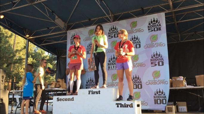
At the podium. Huge congrats to all the runners!
It was, all in all, an unforgettable experience for my first 50 miler. A huge thanks to the Race Director and organizers, and of course the volunteers and city of Big Bear Lake, for hosting such an amazing event. And huge thanks to my coach David Roche, who, like me, just laughed when I told him about my travel schedule and supported me through it all. Most of all, thanks to my amazing husband, Roger Montes, who is my hero and with whom I share all the best adventures. We both run for the Alliance for International Reforestation, and all our race performances are dedicated to them and the work they do to protect nature and the outdoors for the enjoyment and appreciation of all.
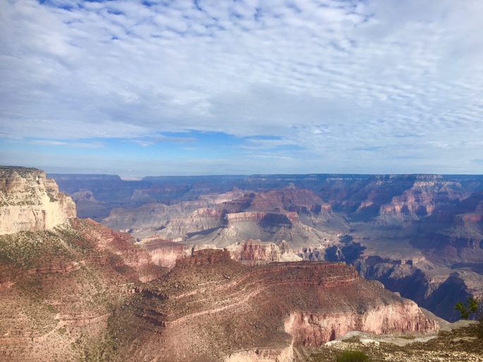
Our third and final stop (step?) on the Grand Staircase was the unparalleled, Instagram-will-never-do-it-justice, [insert well-deserved hyperbole here], Grand Canyon.
I will never forget the first time I saw the canyon (admittedly it wasn’t that long ago – we wrote about our first stop here in 2015 – the visit that just *happened* to coincide with a blood moon/super moon/ harvest moon eclipse). I remember when we were driving up, asking myself the question of whether or not I would *really* be impressed when I first saw it? I mean, I had seen so many photos of the canyon – its river and wind-eroded cliffs were familiar shapes that had been etched into my mind since grade school, featuring prominently in so many textbooks, nature shows, etc.; I was wondering if, given this familiarity, I would still be privileged enough to have the same awestruck sense of wonder that so many claimed to captivate them?
Of course, the answer was – and still is – a wholehearted, full-throated, resounding YES. There is a reason the Grand Canyon is one of the Natural Wonders of the World. Apart from its stunning vistas that make even the most amateur photographer look like Ansel Adams, the canyon is a geologic marvel that tells the tale of the growth of the continent – a violent story of clashing of massive plates, of rising and falling seas – in varying shades of sandstone, limestone, granite, and shale.
In short, there is a reason why the Grand Canyon attracts more than 5 million visitors from around the globe every year. And there is a reason why, on a hot weekend in July, we found ourselves returning yet again.
The last time we visited, we only stayed for a night, and were afforded only a brief trip down the Bright Angel trail – an all-too-quick out-and-back 10 mile jaunt that left us wanting more. *This* time, we had a few more days – and we wanted to make the most of it with a longer rim-to-river-to-rim expedition.
The route we opted to take was down the South Kaibab trail across the Colorado to Phantom Ranch, and then back across the river up the Bright Angel trail. All-in-all, the route would be about 17 miles – with over 5,000 feet of climbing.
Two of the most important things to keep in mind when running or hiking in the canyon in the summer: pay attention to the water and the heat. In 2017, the park had over 1,100 emergency service requests – many due to cases of overheating and dehydration. These challenges can easily be mitigated by planning ahead: leave early in the day to beat the heat, carry plenty of water, and know where you can replenish it.
We were very careful to plan ahead, and started our run just after 5 in the morning. At peak summer hours, it was already light enough to see without a headlamp.
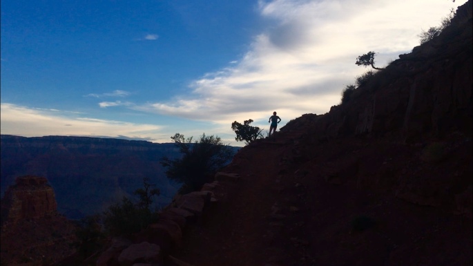
Descending the South Kaibab trail in the early morning hours was both surreal, and a bit scary. Surreal because of the views – seeing the canyon turn varying shades of gold and pink as the sun slowly rises over it is nothing short of magical – and scary because you realized that one misstep on the dusty, loose gravel trail could send you skidding over the side into nothingness. Nevertheless, it was incredibly peaceful in a way, as you were so focused, so attentive to your surroundings and footsteps, that you could not afford to pay attention to anything else. It was an exercise in mindfulness.
Descending the South Kaibab on a clear morning in July.
With that said, it is also a *long*, 6 mile descent into the canyon, and as we neared the end, I was very mindful of the fact that my quads were feeling it.
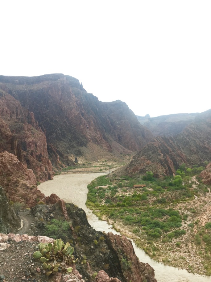
But then, I saw the river.
Catching our first glimpses of the Colorado River, with the Silver Bridge in the distance.
I almost completely forgot any discomfort, and was completely absorbed and amazed by the fact that we were at the source of it all – that this seemingly humble, slightly muddy ribbon of rushing water was the force that had carved this massive, 277 mile gorge and intricate network of cliffs, and slot canyons into the earth, indelibly changing the face of the landscape forever. It was just as impressive as the canyon itself.
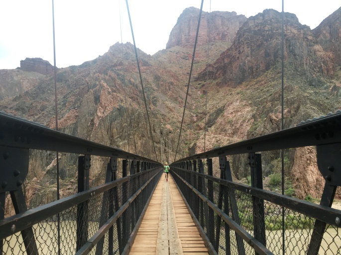
We crossed the river on the Black Bridge, a narrow, swinging suspension bridge that took us from South to North Rim, and then on to Phantom Ranch. Here was our first water stop, and after a 1 hour+ descent, we were already thirsty and knew we needed to refill our bottles – as the next part was the hard part.
Roger crossing the Black Bridge.
Coming back on the River Trail and then the Bright Angel Trail was admittedly much more difficult than I had initially thought. The long downhill on the South Kaibab had already tired my legs, and the way back up was essentially 5,000 feet in 8 miles. It was also much, much hotter than it was when we had started; in just a few hours the temperature had risen 30 degrees. And it was only getting hotter.
I just focused on keeping a steady effort, and getting to my next water station at Indian Garden. Once I had, I was nearly out of water – after only a few miles up from Phantom Ranch. Fortunately, the final few miles were up the Bright Angel Trail, which has periodic water stops every few miles. I knew I would be fine with water – but this was also the steepest part of the trail.
I was already tired, and continued to focus on maintaining a consistent, relaxed pace alternating running and power hiking – with occasional unexpected but very welcomed words of encouragement from friendly hikers – including AIR’s president!
We ended up finishing our rim-to-river-to-rim run in just over 3.5 hours, and just before the peak heat of the day. It will rank as one of my all-time favorite runs. Check out our route here!
One note: The National Park Service does not recommend doing the rim-to-river-to-rim in one day for most people. We definitely do not advise attempting this, either; it should be noted that we are experienced trail runners and trained to undertake events like this. However, the route can easily be broken into a multi-day adventure, which many do, with an overnight stay in Phantom Ranch.
Interested in going? While summer months are some of the most popular times to visit the canyon, they are also hazardous, as overheating and dehydration are common during this time of year. Be sure to leave early and carry plenty of water – and chart your water stops in advance!
Check out the park website here for more information on planning your visit.
And as always, a huge thanks to the NPS and rangers for everything they do to protect our parks and park visitors alike.
From the park occupying the uppermost step – Bryce – the Grand Staircase descends to the region where Zion National Park is located. Covering roughly 232 square miles in southwest Utah, Zion is a nature lover’s playground, with a dizzying array of towering sandstone cliffs, narrow slot canyons, and miles of trails to explore.
Unfortunately, the geologic features that make Zion such a national treasure also make it a hazard – especially during the rainy season of July through September. During these months, heavy rains that saturate parched desert lands can lead to flash floods. In the canyons, tons of mud, boulders, and other debris are channeled through narrow spaces in fast moving currents that spell serious damage and destruction for anything in their path.
This was the case when we visited Zion in mid-July, arriving in the park only days after a series of flash floods had destroyed some of the most popular trails in the park – including Angels Landing, Upper Emerald Pools, and Kayenta.
In spite of the damage – a testament to the power of Mother Nature – we endeavored to make the most of our stay. Zion is still an incredibly impressive park to experience after all, and if anything, the damage left behind by the floods was only a reminder of the strong and sometimes violent forces that created the park’s remarkable features.
For our stay in Zion, we were thrilled to be joined by Dr. Anne Hallum, president and founder of our sister organization and namesake, AIR. She joined us on a number of hikes throughout the main canyon on trails that were still open – and beautiful – including hikes to the Lower Emerald Pools and Weeping Rock.
On our way to the Lower Emerald Pools! …On the part of the trail still intact…
The next day, we opted for one of the longer – and more strenuous – routes from the canyon floor to the top of Observation Point, the highest point in the park. This trail is well maintained and marked, but very challenging (especially as a run!), as it climbs over 2500 feet in 4 miles. That said, it offers breathtaking (quite literally) views, as you climb the winding switchbacks in the first 1-2 miles, before ducking into one of the narrow canyons Zion is famed for – and getting a bit of respite from the morning sun in its cool shadows. When we were here last, we were treated to a herd of the park’s resident mountain goats here! After the canyon, the trail climbs another several exposed switchbacks before leveling out in the last mile along the top of the rim. Here, you’re able to relax and run or hike along a relatively flat section of fine red clay until you reach the eponymous observation point itself, and be rewarded with a panoramic view of the valley for all your hard work and near cardiac arrest. Check out our route here!
Interested in going? Be sure to visit the park website and plan your trip well in advance – Zion is popular, and reservations at nearby hotels fill up quickly! Also be aware that private cars are not allowed in the main canyon, but a convenient free shuttle will take you to all the major trailheads.
The AIR Adventures team is on the road again this summer, for our annual tour of national and state parks! This time, the theme is canyons, as we’ll be visiting the corners of Utah and Arizona where some of our country’s most popular canyon parks, including Bryce, Zion, and of course, the Big Ditch (aka Grand Canyon). Taken together, these three parks make up part of the Grand Staircase – a vast region made up of different plateaus canvassing millions of acres across Colorado, Utah, and Arizona.
Our first stop was the uppermost ‘top’ step of the staircase in Southwest Utah, where Bryce Canyon is located. The park is by no means the largest – spanning just over 35,000 acres – but it certainly packs a strong visual punch in that circumscribed space. Specifically, Bryce is known for its ‘hoodoos’ – rock formations that have been shaped and twisted by erosion over time into fantastical and bizarre sculptures (insert some overused wordplay joke about ‘Hoodoo – you do, she do, we do!’ here). Bryce Canyon boasts the largest collection of hoodoos in the world.
We opted to explore this strange landscape on foot, as Bryce has over 65 miles of trails winding throughout. Our first run took us on a loop around ‘Fairyland,’ where the trail started us on a series of switchbacks that zigged and zagged over a mile down into the Bryce amphitheater, before turning into a rollercoaster of twists and turns that wound its way through some of the most eye-popping collection of wind- and sand-chiseled rocks in all manner of strange shapes and sizes. It was easy to see how this section of the park earned its name, as we could easily imagine the rocks to be some petrified remnants of magical flora and fauna. All-in-all, the run totalled about 8 miles from Sunrise Point, with just over 1600 feet of elevation gain. Check out our route here!
Adventures in Fairyland.
The next day, we ventured out into the less popular – but equally impressive – wilderness of Bryce Canyon. While most of the park’s 2 million+ annual visitors stick to the hoodoo viewpoints, fewer take the opportunity to explore the backcountry of the park. However, it’s on the less-traveled wilderness trails where one can truly appreciate the ecological splendor and value of Bryce. With the altitude of the park ranging some 2000 feet, it encompasses three distinct climate zones, each home to a wide array of plant and animal life – including mountain lions, pronghorn, and the endangered Utah prairie dog. Our trek into the backcountry took us on an out-and-back route along the Rim Trail from Sunset Point to Bryce Point, where we then took the Under the Rim Trail that descended over 2,000 feet down into the valley floor to Yellow Creek. While we’d originally planned a point-to-point rout that would end at the Whiteman Bench, at Yellow Creek the trail became difficult to find and we opted to play it safe and return the way we came. All-in-all, this route took us nearly 14 miles, with some 2500 feet of elevation gain – all on the return trek, of course! Check out our route here!
Throughout our stay, we also opted for a few shorter, 1-3 mile hikes that also afforded beautiful – and more easily accessible – views. These included the popular hike through the Queen’s Garden, as well as the Bristlecone Loop bear Rainbow Point – one of the highest points in the park.
Interested in going? Definitely take a moment to check out the park’s website and plan your hiking or running routes here. Be aware that especially when hiking the backcountry, the trail conditions and signage are variable, and (as we discovered) the trail may not be as well-maintained as it is near the hoodoos and in the more popular areas of the park. We definitely recommend downloading a GPS map that allows you to track your location, to avoid getting lost in the backcountry. Just as important: be aware that during the summer months, it gets *hot* – and quick! Start your hikes or runs early in the day, and bring plenty of water to avoid dehydration.
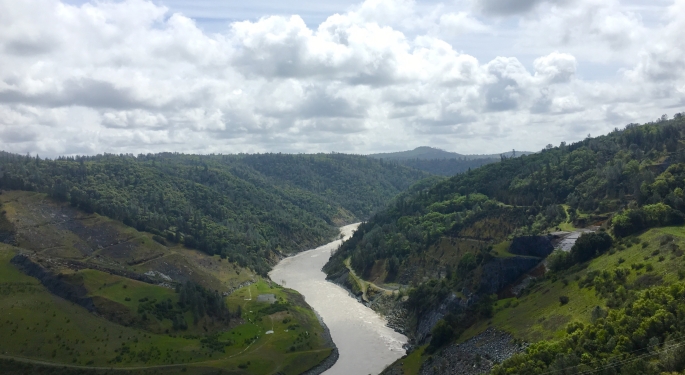
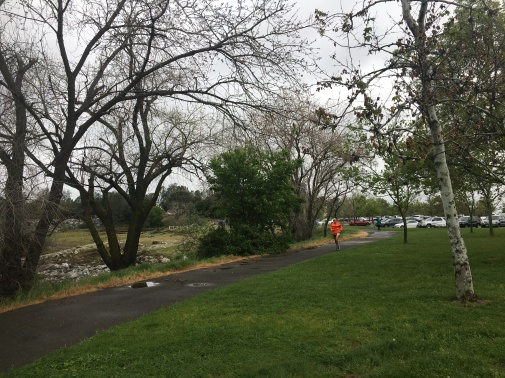
The morning of Saturday, April 7 in Folsom, California was a dismal, cold, and sloppy mess. Unrelenting rain for the past 12 hours had turned the roads and trails in the area into mini-rivers. The start line for the famed American River 50 Mile Endurance Run had to be moved; its original location was completely flooded.
Notwithstanding these less-than-ideal conditions (understatement of the year), nearly 500 hardy souls toed the line at 6am for one of the oldest ultras in the U.S., bravely ready to tackle the course and elements.
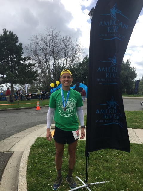
Roger all smiles just before the 6am start.
Roger Montes was one of the starters, and excited to represent the Alliance for International Reforestation at his first 50 mile attempt. After just over 8 hours battling the rain and cold, he crossed the finish line in 6th place – a remarkable result given not just the weather but highly competitive field. We sat down with him afterwards for a re-cap of the day.
Q: So this was your first 50 miler. Overall, how did it play out for you?
A: The weather was tough, to be sure – and the biggest wildcard of the race. But once you’re at the start line, you just have to focus on what’s ahead; everyone has to deal with the same conditions, so it’s just how you manage through them. The first 25 miles were pretty flat and smooth, so I just focused on holding a steady pace through them. I was running in 5th throughout, and feeling good overall although I noticed a dull ache in my right knee after mile 20. When I got to the Beal’s Point aid station at mile 25, my wife Rachel was there. I told her I’d been having a bit of knee pain, but she helped me to put it into perspective and we agreed that she would meet me at the next aid station, and if it was still bothering me I’d drop – no sense in risking long-term injury. Shortly after Beal’s Point, the course transitioned to an unpaved trail, and the softer terrain helped my knee. I saw Rachel again at mile 31, and told her I was fine to continue. After that, it was just about maintaining a steady pace and saving enough energy for the last few miles to tackle the last big climb. I was able to do this, and passed another runner in front of me, although two more passed me just before the climb. It was a pretty strong field – huge congrats to Zach , Coree , and all the runners for great performances!
Roger heading into Beal’s Point, at mile 25.
Q: Wow, so in spite of the conditions it sounds like a great race nevertheless. What was the most challenging part of it for you?
A: Honestly, it was the super slippery trails – and I didn’t bring the right shoes for the job. I was thinking that because so much of the route was on paved bike paths, that I could get away with a shoe tailored more towards the road than the trails. That was a huge mistake! The rain turned the trails into a slippery mess, and without the proper shoes I was sliding all over the place. This not only slowed me down a bit, but could have led to injury – I fell a couple of times out there!
…and all smiles again afterwards! (just slightly more muddy)
Q: What, if anything, would you do differently next time? What were the biggest lessons learned?
A: Next time, for a race I’ve never done I will definitely invest time in scouting the course beforehand. [Editor’s Note: We did this for the Sean O’Brien 100K, and it made a world of difference on race day – barring an unforeseen injury, it helped tremendously!] It’s important to familiarize yourself not just with the race route, but also the types of terrain you’ll be running. If I had done this beforehand, I would have seen that the trails were the type of clay that can turn really nasty in the rain – and I would have prepared better with bringing the right shoes! All in all, though, it was a great experience – the race directors and volunteers put on an amazing race in terrible conditions. Huge thanks to them for being out in the rain for hours! And if anyone is considering this for their first 50 miler, I’d absolutely recommend it.
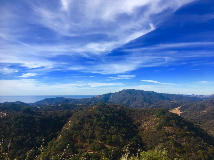
On February 3, just a short time ago, I lined up at 5am with hundreds of other lost, shivering souls to take on the infamous Sean O’Brien 100k – a trail race that traverses the rugged Santa Monica mountains of Southern California. With over 13,000 ft of elevation over a mix of rocky singletrack and long fire roads, I knew it was going to be a tough first attempt at a race of this distance. Moreover, this year’s event was going to be especially competitive – as the SOB 100k is only one of five Golden Ticket races for a coveted Western States entry. At the start line, counting down the seconds before the horn blared, I did my best to remind myself to stay calm, enjoy the experience, and find some semblance of comfort in the knowledge that I’d put in a solid block of training to build up to this.
Everything after the start was a bit of a blur, with a few standout moments (both epically beautiful and epically catastrophic). I’ll do my best to recount:
Miles 0 – 6: A steep uphill climb in the pitch black. For over an hour, my world was reduced to the tiny illuminated patch of trail lit by my headlamp. Then, an amazing moment shortly after cresting the top of the climb, when the sun also rose above the mountains and lit the entire world pink. The view was amazing, and I ran along in stunned silence, scarcely believing I was fortunate enough to be doing this. At this point, I was running around 12th place in the women’s field.
Miles 7 – 17: A rocky singletrack rollercoaster along the Backbone trail. Lots of steep ups and downs, with lots of technical footwork. Another epic moment on a fun downhill section when Led Zeppelin’s ‘Immigrant Song’ came over my playlist, and everything was perfect. I passed a couple of women, and was running around 10th place.
Miles 18 – 22: Loooooong fire road downhill, from the mountains to the beach. Had fun settling into my stride, and enjoying ocean views the entire way. Continued to pass some people on the downhill, and tried to ignore the nagging thought in the back of my mind that I soon was going to have to come alllllllllll the way back up this mountain.
Arriving at the Mile 22 aid station, on a beautiful (and hot!) early spring day in Southern California.
Miles 23 – 31. OUCH. The uphill, back from the beach to the top of the mountain. This was up very steep singletrack that wound its way through Zuma Canyon. At this point of the day, it was mid-morning and the sun was starting to beat down. There were lots of cramping, dehydrated, overheated runners that I passed along the way.
Mile 31: The catastrophic moment. Just after cresting the climb, I settled in for what I was (hoping) would be a nice downhill reprieve. I was feeling good, and again started passing people on the downhill. On one section of off-camber trail, I made a move to pass someone and hopped to the left side of the trail – and felt my left knee give a little. I tried to shrug it off, but in the back of my mind I knew that it didn’t feel right.
Mile 31 – 40: Spent the next 10 miles trying to shake off the knee pain, but it was becoming increasingly difficult to run. The downhills were especially excruciating. By mile 38, I was reduced to walking. One by one, I counted all the people I had passed earlier pass me again. By mile 40, I noticed swelling in my left knee. I made the heartbreaking decision to drop.
Mile 40 – 42: This was a struggle to make my way to the next aid station, where my family would be able to meet me. Upon arriving, I met with the medic who checked out my knee and informed me that unless I wanted to do long-term damage, I should go ahead and stop. My race was done.
While I ultimately failed to achieve my race goal, in many ways I consider this first 100k attempt a success. I felt great throughout – strong and steady on the climbs, and smooth on the downhills – testament to the training and long miles that built up to the race. The heat was another wild card, but this was something that Roger and I had prepared for: we packed a cooling towel, sun sleeves, and we had planned that I’d fill my cap with ice at every aid station. It worked: while the heat was getting the best of many people, I felt good throughout. Apart from my knee, if you had asked me at mile 42 if I could run the last 20 miles, the answer would have been an enthusiastic and whole-hearted YES.
With that said, injuries are a part of this beautiful, fun, and challenging sport. So is the need to make tough decisions with your long-term health in mind. While it was heartbreaking to drop from a race where I had been running in the top-10 for most of it, I also knew it was the right decision to make. Now, just a couple of short weeks after, I’m happy to report feeling well-recovered, and ready to tackle the next adventure.
One final note: Being able to do these events would be impossible without the amazing support of a crew and the volunteers who make these events happen. So first off, a HUGE THANKS to my amazing husband for his endless support and encouragement – from the time I told him I made the crazy decision to register, through to picking me up at mile 42, his support was unwavering. Thanks, too, to my dad and his wife who came out to cheer me on along the course! 8 hours is a looooong time to spectate and cheer – whew! – but their smiles were infectious and kept me going strong. Of course, a huge shoutout to the volunteers, who were also out there all day, attending to – and anticipating – all runners’ needs, even when we were unaware of them. You guys are amazing. Finally, a huge THANK YOU to the Alliance for International Reforestation – our sister organization – who Roger and I are representing this year in our races. We received a lot of interest about AIR on the race course, and really – being able to raise awareness of the incredible work this organization does – is the important thing. Thanks for reading.
Happy New Year, adventurers! We hope you enjoyed a wonderful holiday break, with lots of great quality time with family, minimal travel delays and holiday stress-induced meltdowns, and copious amounts of just the right amount of heavily spiked eggnog.
We at AIR Adventures are especially excited to kick off 2018, as we have a great series of races lined up for this year. While we’re thrilled to be able to compete in these events, we’re even more excited to announce that we’ll be doing so to raise funds for our sister organization and namesake, the Alliance for International Reforestation! We’ll be starting off with some of the best-known – and toughest – races the west coast has to offer, including:
The Sean O-Brien 100K on February 3. Taking place in the rugged Santa Monica mountains, this race traverses 62 miles of rocky single track and fire roads with over 16,000 feet of elevation gain. It’s also one of a handful of Golden Ticket races for the prestigious Western States Endurance Run.
The American River 50 on April 7. An internationally known – and highly competitive – 50 miler that winds along the American River in NorCal, before kicking up a challenging climb to the finish.
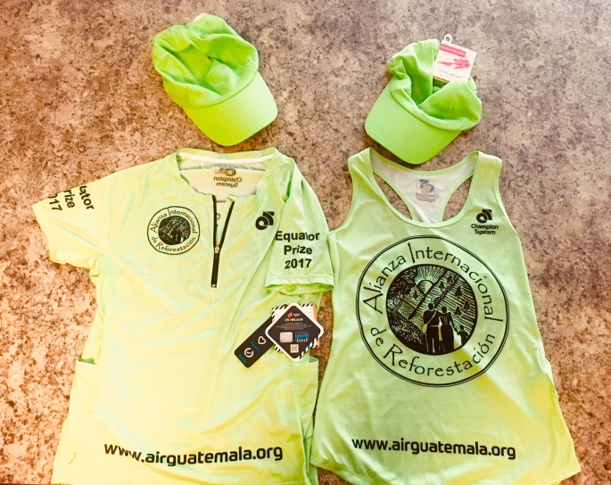
The AIR Adventures team will be representing the Alliance for International Reforestation at all events this year. Thanks to Champion System and Headsweats for the great gear.
We invite you all to follow along as we provide updates on our training – along with race reports – throughout the next several months. And of course, we also invite you to donate to the Alliance for International Reforestation here. We encourage you to match our race distance with a dollar per mile donation! So 62 miles = $62, or 50 miles = $50…you get the idea. 🙂
Thanks as always – and stay tuned for more updates!


 From the park occupying the uppermost step – Bryce – the Grand Staircase descends to the region where
 The AIR Adventures team is on the road again this summer, for our annual tour of national and state parks! This time, the theme is canyons, as we’ll be visiting the corners of Utah and Arizona where some of our country’s most popular canyon parks, including Bryce, Zion, and of course, the Big Ditch (aka Grand Canyon). Taken together, these three parks make up part of the Grand Staircase – a vast region made up of different plateaus canvassing millions of acres across Colorado, Utah, and Arizona.