Tour of the Canyons Part 2: Zion

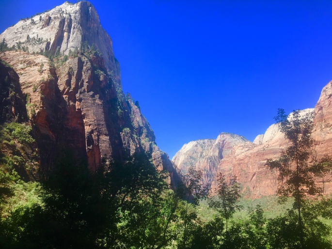
AD31837E-A17C-426E-B4C9-0BC6640E86A5From the park occupying the uppermost step – Bryce – the Grand Staircase descends to the region where Zion National Park is located. Covering roughly 232 square miles in southwest Utah, Zion is a nature lover’s playground, with a dizzying array of towering sandstone cliffs, narrow slot canyons, and miles of trails to explore.

Unfortunately, the geologic features that make Zion such a national treasure also make it a hazard – especially during the rainy season of July through September. During these months, heavy rains that saturate parched desert lands can lead to flash floods. In the canyons, tons of mud, boulders, and other debris are channeled through narrow spaces in fast moving currents that spell serious damage and destruction for anything in their path.

This was the case when we visited Zion in mid-July, arriving in the park only days after a series of flash floods had destroyed some of the most popular trails in the park – including Angels Landing, Upper Emerald Pools, and Kayenta.

In spite of the damage – a testament to the power of Mother Nature – we endeavored to make the most of our stay. Zion is still an incredibly impressive park to experience after all, and if anything, the damage left behind by the floods was only a reminder of the strong and sometimes violent forces that created the park’s remarkable features.

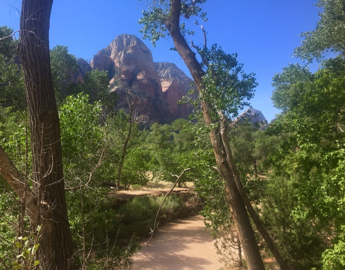
For our stay in Zion, we were thrilled to be joined by Dr. Anne Hallum, president and founder of our sister organization and namesake, AIR. She joined us on a number of hikes throughout the main canyon on trails that were still open – and beautiful – including hikes to the Lower Emerald Pools and Weeping Rock.
9DC687A3-325E-4AF3-BCCA-007F6350F356
On our way to the Lower Emerald Pools! …On the part of the trail still intact…

The next day, we opted for one of the longer – and more strenuous – routes from the canyon floor to the top of Observation Point, the highest point in the park. This trail is well maintained and marked, but very challenging (especially as a run!), as it climbs over 2500 feet in 4 miles. That said, it offers breathtaking (quite literally) views, as you climb the winding switchbacks in the first 1-2 miles, before ducking into one of the narrow canyons Zion is famed for – and getting a bit of respite from the morning sun in its cool shadows. When we were here last, we were treated to a herd of the park’s resident mountain goats here! After the canyon, the trail climbs another several exposed switchbacks before leveling out in the last mile along the top of the rim. Here, you’re able to relax and run or hike along a relatively flat section of fine red clay until you reach the eponymous observation point itself, and be rewarded with a panoramic view of the valley for all your hard work and near cardiac arrest. Check out our route here!

Interested in going? Be sure to visit the park website and plan your trip well in advance – Zion is popular, and reservations at nearby hotels fill up quickly! Also be aware that private cars are not allowed in the main canyon, but a convenient free shuttle will take you to all the major trailheads.

Next and final stop: Grand Canyon!
Tour of the Canyons Part 1: Bryce!

1C2E58DC-DE03-4956-9909-4EC72F7F1939The AIR Adventures team is on the road again this summer, for our annual tour of national and state parks! This time, the theme is canyons, as we’ll be visiting the corners of Utah and Arizona where some of our country’s most popular canyon parks, including Bryce, Zion, and of course, the Big Ditch (aka Grand Canyon). Taken together, these three parks make up part of the Grand Staircase – a vast region made up of different plateaus canvassing millions of acres across Colorado, Utah, and Arizona.
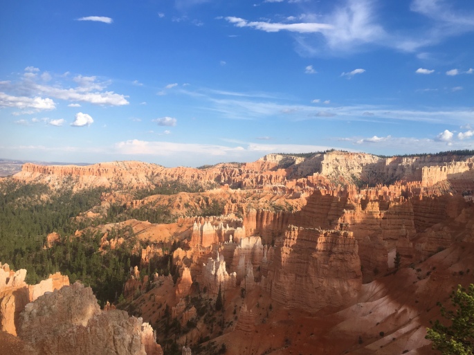
Our first stop was the uppermost ‘top’ step of the staircase in Southwest Utah, where Bryce Canyon is located. The park is by no means the largest – spanning just over 35,000 acres – but it certainly packs a strong visual punch in that circumscribed space. Specifically, Bryce is known for its ‘hoodoos’ – rock formations that have been shaped and twisted by erosion over time into fantastical and bizarre sculptures (insert some overused wordplay joke about ‘Hoodoo – you do, she do, we do!’ here). Bryce Canyon boasts the largest collection of hoodoos in the world.

We opted to explore this strange landscape on foot, as Bryce has over 65 miles of trails winding throughout. Our first run took us on a loop around ‘Fairyland,’ where the trail started us on a series of switchbacks that zigged and zagged over a mile down into the Bryce amphitheater, before turning into a rollercoaster of twists and turns that wound its way through some of the most eye-popping collection of wind- and sand-chiseled rocks in all manner of strange shapes and sizes. It was easy to see how this section of the park earned its name, as we could easily imagine the rocks to be some petrified remnants of magical flora and fauna. All-in-all, the run totalled about 8 miles from Sunrise Point, with just over 1600 feet of elevation gain. Check out our route here!

Adventures in Fairyland.

The next day, we ventured out into the less popular – but equally impressive – wilderness of Bryce Canyon. While most of the park’s 2 million+ annual visitors stick to the hoodoo viewpoints, fewer take the opportunity to explore the backcountry of the park. However, it’s on the less-traveled wilderness trails where one can truly appreciate the ecological splendor and value of Bryce. With the altitude of the park ranging some 2000 feet, it encompasses three distinct climate zones, each home to a wide array of plant and animal life – including mountain lions, pronghorn, and the endangered Utah prairie dog. Our trek into the backcountry took us on an out-and-back route along the Rim Trail from Sunset Point to Bryce Point, where we then took the Under the Rim Trail that descended over 2,000 feet down into the valley floor to Yellow Creek. While we’d originally planned a point-to-point rout that would end at the Whiteman Bench, at Yellow Creek the trail became difficult to find and we opted to play it safe and return the way we came. All-in-all, this route took us nearly 14 miles, with some 2500 feet of elevation gain – all on the return trek, of course! Check out our route here!

Throughout our stay, we also opted for a few shorter, 1-3 mile hikes that also afforded beautiful – and more easily accessible – views. These included the popular hike through the Queen’s Garden, as well as the Bristlecone Loop bear Rainbow Point – one of the highest points in the park.

Interested in going? Definitely take a moment to check out the park’s website and plan your hiking or running routes here. Be aware that especially when hiking the backcountry, the trail conditions and signage are variable, and (as we discovered) the trail may not be as well-maintained as it is near the hoodoos and in the more popular areas of the park. We definitely recommend downloading a GPS map that allows you to track your location, to avoid getting lost in the backcountry. Just as important: be aware that during the summer months, it gets *hot* – and quick! Start your hikes or runs early in the day, and bring plenty of water to avoid dehydration.


Taking in a composition in red: Arches NP

From the high mountain wilderness of northern Wyoming and Montana we continued our journey south, to explore the desert canyons and mesas of Utah.

Since our visit to the Grand Canyon on our cross country trip two years ago, we’ve always wanted to revisit and spend a bit more time in this region – specifically the renowned ‘Grand Circle’ of national parks that includes Grand Canyon, Capitol Reef, Bryce Canyon, Arches, and Zion.

With limited time, we focused our trip on these latter two parks, with Arches NP being our first stop.

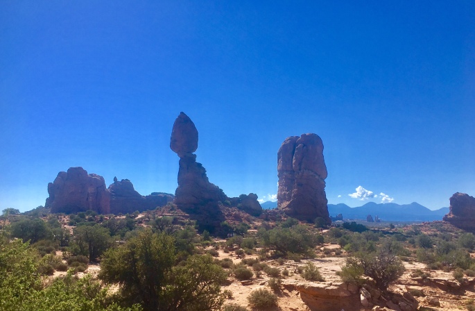
Located just outside Moab in southwest Utah, Arches is an ethereal composition in vibrant red sandstone of grandiose towers, impossibly balanced rocks, and the world’s largest concentration of natural arches. (It’s also by far the most phallic of the national parks. I mean just look at the cover photo).

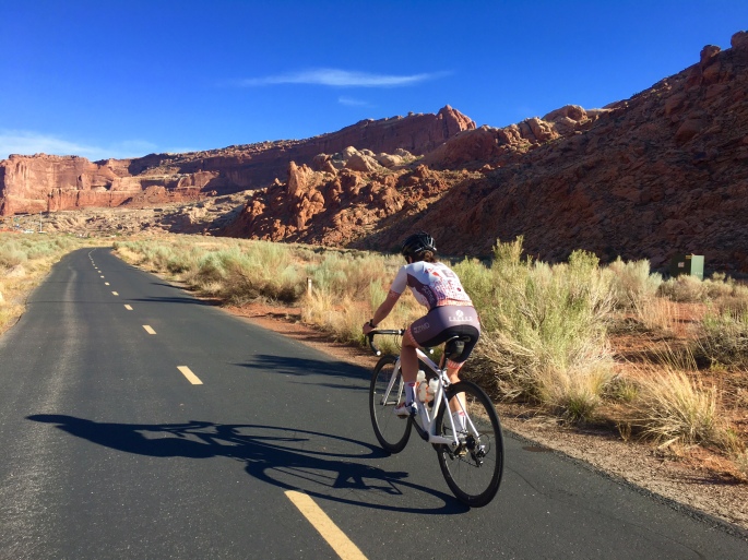
With only a day to explore the park’s 76,519 acres, we decided the best way to do so would be by bike. We started out at the trailhead of a multi-use path just south of Moab, which took us straight to the park entrance. From here, the road kicked up and climbed a little over 1,000 feet – up to a vista point that afforded panoramic views of many of the giant phalluses amazing rock formations for which the park is famed.

FullSizeRender
Balanced Rock. 3,600 tons of sandstone that could topple at any moment, but for now is standing strong for your Instagramming pleasure.

The road that winds through Arches is essentially an out-and-back route totaling a little over 45 miles. Along the way there are many offshoots that take you past the more well-known arches and formations, including Balanced Rock, the Windows, and Delicate Arch – to name a few.

ArchesNP bike
Arches NP by bike. Super hot fun in the desert sun. 

As the day heated up quickly, we did our best to conserve our energy and not go *too* hard on the bike. Of course, there may have been one or two occasions where we picked up the pace to have a bit of fun – and *maybe* took a couple of Strava CRs and QOMs in the process. 🙂

Check out our route here!

Interested in going? Check out the Arches NP website here, with info to help plan your visit. If you’re intending to do a longer bike ride like we did – or spend any extended amount of time there on a hike, run, etc., be sure to:

1) Go early. It gets hot quickly, and the mid-afternoon heat and sun can make your day much less pleasant than it should be.

2) Take plenty of water with you (Why? See point 1 above. It’s the desert. It gets hot and stays hot). If you need to refill your water bottles, there are fountains at both the Visitor’s Center as well as Devil’s Garden (the turn-around point of the out-and-back route).

Fee? Yes – $25. Pets? Yes – but not on trails. Bikes? Yes – on the road.

Stay tuned for our next adventures! We hope your summer was equally adventurous, exploring new trails and beautiful parks. Tell us all about it in the comments below!