Tour of the Canyons Part 2: Zion

AD31837E-A17C-426E-B4C9-0BC6640E86A5
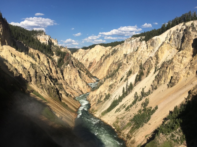
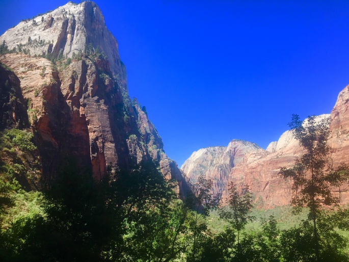
From the park occupying the uppermost step – Bryce – the Grand Staircase descends to the region where Zion National Park is located. Covering roughly 232 square miles in southwest Utah, Zion is a nature lover’s playground, with a dizzying array of towering sandstone cliffs, narrow slot canyons, and miles of trails to explore.

Unfortunately, the geologic features that make Zion such a national treasure also make it a hazard – especially during the rainy season of July through September. During these months, heavy rains that saturate parched desert lands can lead to flash floods. In the canyons, tons of mud, boulders, and other debris are channeled through narrow spaces in fast moving currents that spell serious damage and destruction for anything in their path.

This was the case when we visited Zion in mid-July, arriving in the park only days after a series of flash floods had destroyed some of the most popular trails in the park – including Angels Landing, Upper Emerald Pools, and Kayenta.

In spite of the damage – a testament to the power of Mother Nature – we endeavored to make the most of our stay. Zion is still an incredibly impressive park to experience after all, and if anything, the damage left behind by the floods was only a reminder of the strong and sometimes violent forces that created the park’s remarkable features.

For our stay in Zion, we were thrilled to be joined by Dr. Anne Hallum, president and founder of our sister organization and namesake, AIR. She joined us on a number of hikes throughout the main canyon on trails that were still open – and beautiful – including hikes to the Lower Emerald Pools and Weeping Rock.

9DC687A3-325E-4AF3-BCCA-007F6350F356
On our way to the Lower Emerald Pools! …On the part of the trail still intact…

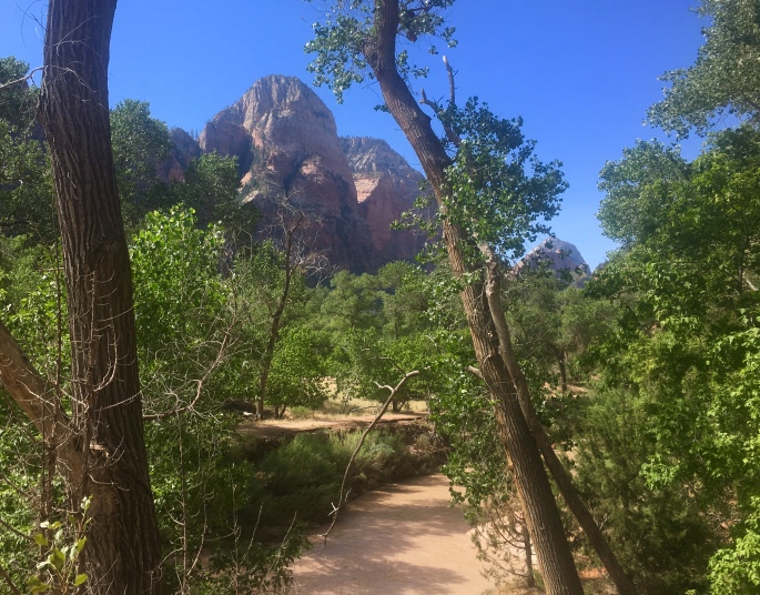
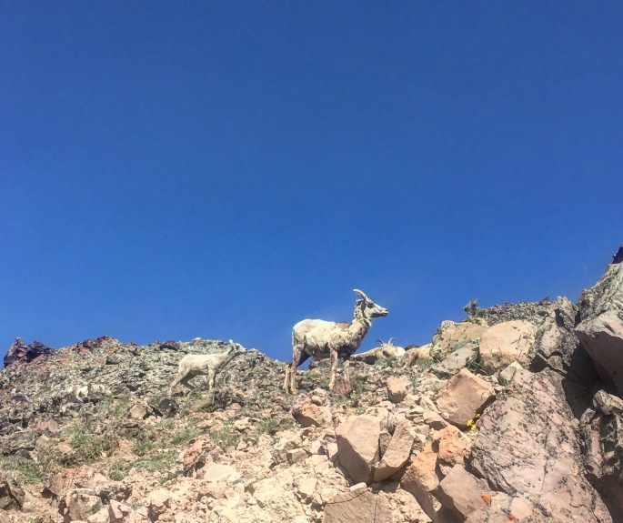
The next day, we opted for one of the longer – and more strenuous – routes from the canyon floor to the top of Observation Point, the highest point in the park. This trail is well maintained and marked, but very challenging (especially as a run!), as it climbs over 2500 feet in 4 miles. That said, it offers breathtaking (quite literally) views, as you climb the winding switchbacks in the first 1-2 miles, before ducking into one of the narrow canyons Zion is famed for – and getting a bit of respite from the morning sun in its cool shadows. When we were here last, we were treated to a herd of the park’s resident mountain goats here! After the canyon, the trail climbs another several exposed switchbacks before leveling out in the last mile along the top of the rim. Here, you’re able to relax and run or hike along a relatively flat section of fine red clay until you reach the eponymous observation point itself, and be rewarded with a panoramic view of the valley for all your hard work and near cardiac arrest. Check out our route here!

Interested in going? Be sure to visit the park website and plan your trip well in advance – Zion is popular, and reservations at nearby hotels fill up quickly! Also be aware that private cars are not allowed in the main canyon, but a convenient free shuttle will take you to all the major trailheads.

Next and final stop: Grand Canyon!

Tour of the Canyons Part 1: Bryce!

1C2E58DC-DE03-4956-9909-4EC72F7F1939
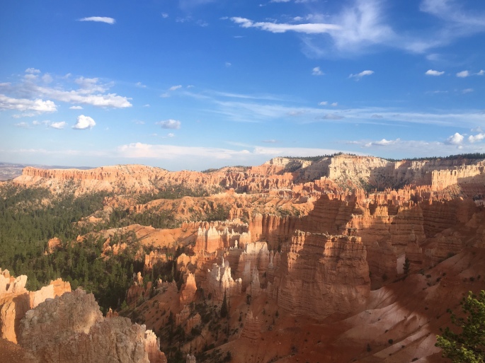
The AIR Adventures team is on the road again this summer, for our annual tour of national and state parks! This time, the theme is canyons, as we’ll be visiting the corners of Utah and Arizona where some of our country’s most popular canyon parks, including Bryce, Zion, and of course, the Big Ditch (aka Grand Canyon). Taken together, these three parks make up part of the Grand Staircase – a vast region made up of different plateaus canvassing millions of acres across Colorado, Utah, and Arizona.

Our first stop was the uppermost ‘top’ step of the staircase in Southwest Utah, where Bryce Canyon is located. The park is by no means the largest – spanning just over 35,000 acres – but it certainly packs a strong visual punch in that circumscribed space. Specifically, Bryce is known for its ‘hoodoos’ – rock formations that have been shaped and twisted by erosion over time into fantastical and bizarre sculptures (insert some overused wordplay joke about ‘Hoodoo – you do, she do, we do!’ here). Bryce Canyon boasts the largest collection of hoodoos in the world.

We opted to explore this strange landscape on foot, as Bryce has over 65 miles of trails winding throughout. Our first run took us on a loop around ‘Fairyland,’ where the trail started us on a series of switchbacks that zigged and zagged over a mile down into the Bryce amphitheater, before turning into a rollercoaster of twists and turns that wound its way through some of the most eye-popping collection of wind- and sand-chiseled rocks in all manner of strange shapes and sizes. It was easy to see how this section of the park earned its name, as we could easily imagine the rocks to be some petrified remnants of magical flora and fauna. All-in-all, the run totalled about 8 miles from Sunrise Point, with just over 1600 feet of elevation gain. Check out our route here!

Adventures in Fairyland.

The next day, we ventured out into the less popular – but equally impressive – wilderness of Bryce Canyon. While most of the park’s 2 million+ annual visitors stick to the hoodoo viewpoints, fewer take the opportunity to explore the backcountry of the park. However, it’s on the less-traveled wilderness trails where one can truly appreciate the ecological splendor and value of Bryce. With the altitude of the park ranging some 2000 feet, it encompasses three distinct climate zones, each home to a wide array of plant and animal life – including mountain lions, pronghorn, and the endangered Utah prairie dog. Our trek into the backcountry took us on an out-and-back route along the Rim Trail from Sunset Point to Bryce Point, where we then took the Under the Rim Trail that descended over 2,000 feet down into the valley floor to Yellow Creek. While we’d originally planned a point-to-point rout that would end at the Whiteman Bench, at Yellow Creek the trail became difficult to find and we opted to play it safe and return the way we came. All-in-all, this route took us nearly 14 miles, with some 2500 feet of elevation gain – all on the return trek, of course! Check out our route here!

Throughout our stay, we also opted for a few shorter, 1-3 mile hikes that also afforded beautiful – and more easily accessible – views. These included the popular hike through the Queen’s Garden, as well as the Bristlecone Loop bear Rainbow Point – one of the highest points in the park.

Interested in going? Definitely take a moment to check out the park’s website and plan your hiking or running routes here. Be aware that especially when hiking the backcountry, the trail conditions and signage are variable, and (as we discovered) the trail may not be as well-maintained as it is near the hoodoos and in the more popular areas of the park. We definitely recommend downloading a GPS map that allows you to track your location, to avoid getting lost in the backcountry. Just as important: be aware that during the summer months, it gets *hot* – and quick! Start your hikes or runs early in the day, and bring plenty of water to avoid dehydration.


Yellowstone: Because what could be more epic than a park on top of a supervolcano.

Following our visit to Craters of the Moon in Idaho, we turned to the northeast, making our way towards the wilderness and famed national parks of northern Wyoming. Our first stop was none other than the flagship park of the National Park Service: the iconic Yellowstone.

Apart from its distinction as the first national park, Yellowstone is also a geologist nerd’s delight: It’s essentially 2.2 million acres atop an ancient supervolcano. Everything in the park – from the rivers and lakes, to the flora and fauna – is in turn affected by the volcanic forces at work. Within the 30 by 45 mile caldera are some of the most impressive geysers and hot springs in the world, including the emblematic Old Faithful and Grand Prismatic Springs, along with lesser known (but equally awesome) features like Dragon’s Breath, Artists Paintpots, and others.

IMG_0605
Yellowstone gets its name from the colored rock surrounding the Yellowstone River, which winds its way throughout the park.

(Important note: When exploring the park’s geysers and hot springs, stick to the boardwalks. The surrounding area is not only fragile, but surrounded by boiling sulfuric acid; you will die a horrible death if you jump in. 😊 )

IMG_0604
These helpful signs found throughout the park show the impending doom that awaits if you step off the boardwalk. You will get hurt while onlookers point and laugh or walk away indifferently.

We spent a total of 4 days in Yellowstone, which we agreed was still not enough time to fully take in and appreciate this massive park. That said, we tried our best to explore as much of it as we could by foot and by bike.

One of our favorite runs/hikes took us to the summit of Mt. Washburn and back down. We started at the trailhead on Dunraven Pass, just off Grand Loop Road. From there, we climbed roughly ~1,500 feet over 3.5 miles to the summit. Along the way, we were afforded sweeping views of the surrounding meadows and countryside, awash in varying shades of lavender, rose, and yellow wildflower blooms.

Near the summit we were happily greeted by a small herd of bighorn sheep! They seemed unafraid of humans, and we did our best to give them sufficient space as we continued to make our way to the summit.

Check out our route up Mt. Washburn here!

IMG_0606
Bighorn sheep silently judging our mountain running skills near the summit of Mount Washburn.

(Another important note: Yellowstone provides a refuge to several species of wildlife; apart from bighorn sheep, it’s also home to buffalo, elk, moose, grizzly and black bears, wolves, and others. If you encounter any wild animal in the park, please be respectful of them and give them space. The park offers guidelines of 100 yards for non-carnivorous species like buffalo and elk, and 200 yards for carnivorous species like bear and wolves. Additionally, it’s a good idea to carry – and know how to use! – bear spray when running, hiking, or biking in Yellowstone or other parks in the region. While bears are not generally aggressive unless provoked, it’s best to be prepared).

The following day, we opted for a bike ride that took us on a 68 mile loop from Canyon Village clockwise to Norris, through Mammoth Hot Springs to Tower, and back up Mt. Washburn before descending back into Canyon. While the ride was challenging – with nearly 6,000 feet of climbing – it was also one of the best ways to experience the the park. We were able to see so much that we otherwise would have missed in the car – including a big bull buffalo rolling in the dust on the side of the road (!), just barely hidden by a small pine grove, or a pair of marmot chasing each other over and around fallen trees.

On our ride, we made another ascent up Mt. Washburn, this time starting from the northern side at the Tower-Roosevelt junction, and making our way up 2,300+ feet over ~10 miles to the summit. The climb offered us breathtaking (quite literally) views of the valley below that we would not have enjoyed or appreciated as much if we had been speeding by in our little Toyota.

IMG_0607
Our bike ride took us through some of the most beautiful – and less traveled – areas of Yellowstone.

Check out our bike route here! (FYI, if you opt to do this route, Mammoth offers a nice halfway(-ish) point for refilling your water bottles).

Before closing out this entry on Yellowstone, we owe a shoutout to Xanterra, the company that manages much of the lodging and dining throughout Yellowstone. They make a concerted effort to prioritize environmental stewardship in everything they do: from building their lodges with beetle-killed pine, to eliminating plastic and styrofoam from both lodging and restaurants. We mention this, because this was in marked contrast to the environmental *irresponsibility* we observed in the dining, general stores, and lodging at Grand Tetons, our next stop.

So our final tally for Yellowstone: 68 miles biked; 26 miles run/hiked; hundreds of buffalo, 10 bighorn sheep, 6 elk, 3 moose, 2 pika, 2 marmot, and 1 bear (grizzly!) sighted.

Interested in going? With ideal weather conditions, late spring and summer are the most popular times to visit Yellowstone. If you’re planning to visit during the months of April – August, be sure to book your lodging/camping reservations months ahead of time.

Fee? Yes – $30 per vehicle for a day pass; national park annual pass also accepted.

Dogs and other pets? Yes, but not on trails. MTB? Yes – on designated trails. Check signs!

Next stop: Grand Tetons!

Exploring the Martian landscape of Craters of the Moon!

Following an all-too-brief stay in Tahoe, the AIR Adventures team headed east, to Idaho, and a pit stop at Craters of the Moon National Monument.

Located just north of the Snake River Plain in Central Idaho, the wonderfully bizarre landscape of this park seems to bubble up from the surrounding plains like some strange brew from an underground cauldron. Indeed, this descriptor is not far from the truth, as the park’s myriad of craters, fissures, and fossilized lava flows that comprise some 750,000 acres owe their existence to the region’s intense seismic activity and violent volcanic past. The most recent eruption occurred only 2,000 (!) years ago.

We opted to explore this strange and somewhat unsettling landscape by foot, as mountain bikes are not permitted on the trails. Additionally, there are a few areas where you have the option to explore caves formed by ancient lava tubes, and which are only accessible by foot (hint: bring a headlamp!).


Our day hike took us from the very top of the Inferno Cone – which at 6181 ft afforded beautiful panoramic views of the entire valley – to the caldera of the immense North Crater, and finally down to the subterranean maze of the Buffalo Caves. Along the way we encountered people of all ages and walks of life enjoying the wonders of the park, including the largest group of Boy Scouts we’ve ever seen. We have no idea how the Scout Masters kept them all accounted for.

Check out our route here!

Apart from being an ideal destination for losing a Boy Scout, Craters of the Moon also is an important ecological site that sustains a diversity of plant and animal life – including six species of bats that make their home in the lava tubes.

 Interested in going? Check out the park’s website here for information on hikes and other activities inside the park. One important note: With the dark volcanic rock and ash, it can get particularly hot during summer months, so try to plan your visit early in the day.

Fee? Yes – $15 per vehicle. National Park Annual Pass also accepted. Pets? In the campground, park lot, and on paved roads. Not on trails. MTB? No.

Next stop: Yellowstone and the Grand Tetons!

In celebration of national parks – preserving ‘everyone’s stories’ (part 2).

Some 145 years ago on March 1, 1872, then-president Ulysses S. Grant signed a bill creating the nation’s first national park – Yellowstone. However, it wasn’t until decades later, in 1916, that the National Park Service (NPS) was created to manage and protect the large – and growing – number of parks throughout the U.S. The battle to protect the Grand Canyon was instrumental to the development of the NPS.

In our last blog entry, we highlighted the environmental value of our national parks. This latest entry focuses on their historical value – and the role they play in preserving ‘everyone’s stories.’

While national parks play a prominent role in protecting natural landscapes and unique environments, they play an equally important role in protecting the diverse histor(ies) of our nation – dating back to the Paleo-Indian tribes who first set foot in North America some 12,000 years ago.

The iconic Grand Canyon is a prime example of a park preserving both nature and history. As one of the Seven Natural Wonders of the World, the Grand Canyon has become a worldwide symbol for the grandeur of the American West. The park – designated as a UNESCO World Heritage site – is over 1.2 million acres in the northwest part of Arizona. The canyon itself is a geological marvel, averaging a depth of 4,000 feet for roughly 277 miles. Moreover, the park provides a wealth of biological diversity with three different desert types and five distinct ‘life zones’ – each home to several rare and endemic plant and animal species like the desert bighorn sheep and desert shrew.

Moreover, the Grand Canyon also played a pivotal role in the development of our National Park System: it was in part out of a desire to protect the canyon that Stephen Mather fought to establish the NPS, as a way of better managing and protecting the parks. While the Grand Canyon did not gain official park status until 1919, nearly 3 years after the NPS was established, many credit it with Mather’s drive to develop and lead the NPS as its first director.

The human history of the Grand Canyon dates back much further than the creation of the NPS, of course: artifacts dating back nearly 12,000 years have been discovered within the canyon, evidence of early Paleo-Indian tribes. Currently, 11 traditionally-associated tribes and historic ethnic groups are involved in co-managing the park, as part of the preservation of their cultural heritage. These include the Havasupai, Hopi, Hualapai, Navajo, Paiute, White Mountain Apache, Yavapai Apache, and Zuni tribes.

Interested in visiting? Check out the park’s website here, which includes information on how to plan your visit, as well as important weather advisories. The AIR Adventures team had the privilege of visiting as part of our cross-country road trip in 2015. We stayed at the historic El Tovar Hotel, built in 1905 on the South Rim. We recommend taking some time to hike or run the Bright Angel Trail, a 6 mile one-way trail that starts from the South Rim and takes you on a scenic tour into the canyon. A note of caution, though! The trail goes straight down – meaning the distance you go down equals the distance you have to come back up! Do not underestimate the challenge of the hike back out of the canyon.

Fee? Yes – $30 per vehicle.

Bikes? Yes – in designated areas. Rentals are available on the South Rim.

Dogs? Yes – in designated areas, and on leashes. The South Rim trails are particularly dog friendly.

Interested in learning more? Then check out the Grand Canyon site here, or to learn more about the NPS and its history, check out their webpage here.

Interested in supporting global conservation efforts? 

Then check out the Alliance for International Reforestation, a globally-recognized organization dedicated to sustainable, community-based reforestation efforts. Pledge to donate today!