Marin Ultra Challenge 50K Race Report (finally!)

I have no idea how March has already come and gone – it’s been a whirlwind 2019 so far with lots of work activity, an upcoming move and massive career shift, and of course, ultra season is in full swing!

All of this is also a long-winded way of saying that I am woefully late in posting my first race report of the season, from the Marin Ultra Challenge 50K, held on March 9 in the gorgeous and iconic Marin Headlands, just north of San Francisco.

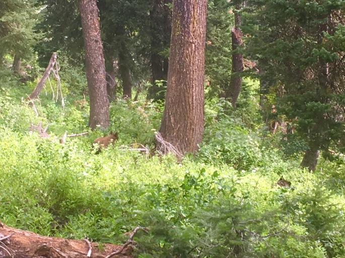
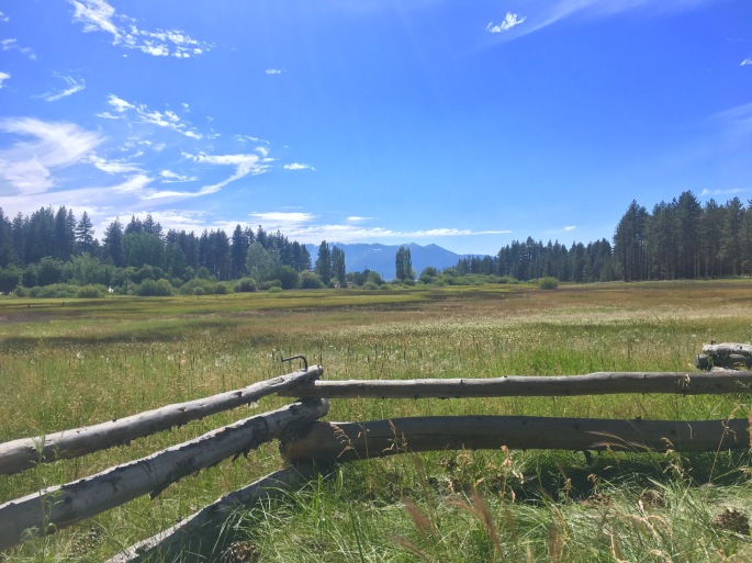
The Marin Headlands is part of a larger system of protected land that comprise the Golden Gate National Recreation Area (GGNRA), which was established by Congress in 1972 with the progressive and forward-thinking aim of offering an urban population the opportunity to experience and enjoy diverse protected plant and animal life normally found only in larger national parks. (It is fairly normal, for instance, to see coyotes like the one featured above casually sauntering along the roadways in the headlands, uncaring of the passing traffic or excited pointing and exclamations of visitors. It is, after all, their territory). All-in-all, the headlands is a gorgeous area characterized by rolling foothills and mountains with sweeping vistas of San Francisco, the Bay, and the Pacific. Not surprisingly, its miles of undulating trails are also incredibly popular with trail runners and mountain bikers.

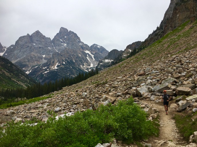
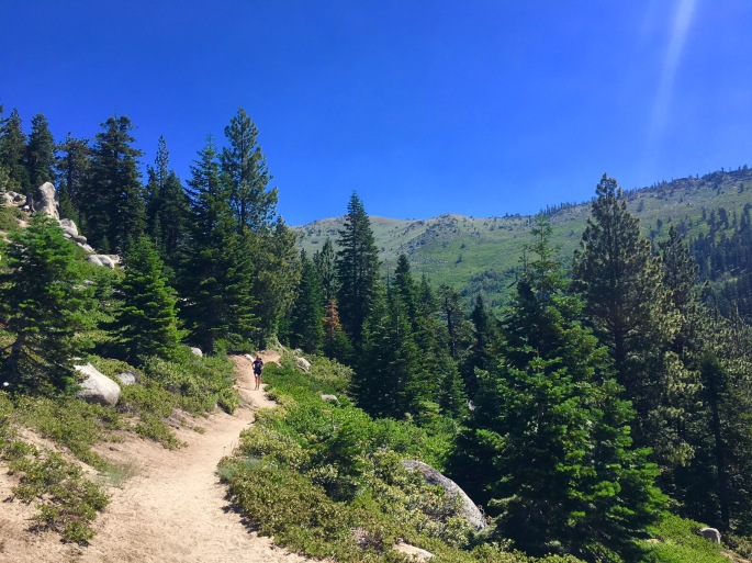
For runners, the trails are as tough as they are beautiful, all steep ups and downs, with virtually no flat sections.

Lining up at the start, thinking about all the steep terrain, I knew this was going to be a tough race.

MUC_elevation
Over 6200 feet of elevation gain in a little over 30 miles. The course profile looked like teeth a great white would envy.

They counted us down, and blew the horn to send us off.

It started to pour.

Not surprisingly, we started off with a climb – about 2 miles straight uphill. I started off alongside the inspiring rockstar Katie Arnold, a professional ultrarunner and author who won the competitive and tough Leadville 100 miler in Colorado last year.

MUC_start
At the start! Still relatively fresh and warm.

We stayed together for only a little while before Katie took off – I didn’t see her the rest of the race.

From miles 2 -10-ish, I remember little except a series of up-up-ouch-up followed by steepfastdownhills. Because of the rain and cold, I wasn’t sweating that much, and so I opted to not stop at the first aid station, waiting until the next aid station at Tennessee Valley before grabbing a gel and some sports drink. From there, we got a bit of respite from the climbs as we headed to Muir Beach, before hitting another wall straight up at mile 14. Here, we did a quick out and back, before returning back to Muir Beach around mile 20.

At this point I made the mistake of taking a quick nature break at the aid station.

Apparently at this time 2 women passed me (unbeknownst to me at the time).

I spent less then 2 minutes at the aid station before heading back out – and up! – another steep climb. I was admittedly getting tired by this point – my hands and legs were numb, and I was feeling like I was on the verge of bonking (i.e., running completely out of energy). At this point, Ashley Hall – a badass runner from Reno, NV – caught up with me on the climb. We chatted for a bit, and it was nice to share some miles with a friendly face. Nevertheless, as the climbs continued, I could feel myself starting to fade. I waved her on.

MUC_course
The race took us on a proper tour of the Marin Headlands!

From mile 24 on, it was just a slow grind, with me trying to gut it out as much as possible and maintain my position. There was one last, final climb before the finish that was the steepest of the day and just mean. Remarkably, I caught one woman who had passed me, and I continued on; when I got to the top, I saw that I was gaining on another woman! I let it out on the downhill mile into the finish, trying to make up as much ground as I could. I was closing on her, but simply ran out of room…

I ended up finishing 4th in 5:00:55, less than 20 seconds behind 3rd.

In spite of missing out on the podium, I could not be disappointed with the results: on what has been my hilliest 50K by far, I managed to PR by 20 minutes.

Plus, Roger was there with me, cheering me in, and even took me out to a massive, greasy diner breakfast at a local dive afterwards.

That was a total win, in my books.

On to the next!


Tour of the Canyons Part 3: Grand!!!

Our third and final stop (step?) on the Grand Staircase was the unparalleled, Instagram-will-never-do-it-justice, [insert well-deserved hyperbole here], Grand Canyon.

I will never forget the first time I saw the canyon (admittedly it wasn’t that long ago – we wrote about our first stop here in 2015 – the visit that just *happened* to coincide with a blood moon/super moon/ harvest moon eclipse). I remember when we were driving up, asking myself the question of whether or not I would *really* be impressed when I first saw it? I mean, I had seen so many photos of the canyon – its river and wind-eroded cliffs were familiar shapes that had been etched into my mind since grade school, featuring prominently in so many textbooks, nature shows, etc.; I was wondering if, given this familiarity, I would still be privileged enough to have the same awestruck sense of wonder that so many claimed to captivate them?

Of course, the answer was – and still is – a wholehearted, full-throated, resounding YES. There is a reason the Grand Canyon is one of the Natural Wonders of the World. Apart from its stunning vistas that make even the most amateur photographer look like Ansel Adams, the canyon is a geologic marvel that tells the tale of the growth of the continent – a violent story of clashing of massive plates, of rising and falling seas – in varying shades  of sandstone, limestone, granite, and shale.

In short, there is a reason why the Grand Canyon attracts more than 5 million visitors from around the globe every year. And there is a reason why, on a hot weekend in July, we found ourselves returning yet again.

The last time we visited, we only stayed for a night, and were afforded only a brief trip down the Bright Angel trail – an all-too-quick out-and-back 10 mile jaunt that left us wanting more. *This* time, we had a few more days – and we wanted to make the most of it with a longer rim-to-river-to-rim expedition.

The route we opted to take was down the South Kaibab trail across the Colorado to Phantom Ranch, and then back across the river up the Bright Angel trail. All-in-all, the route would be about 17 miles – with over 5,000 feet of climbing.

Two of the most important things to keep in mind when running or hiking in the canyon in the summer: pay attention to the water and the heat. In 2017, the park had over 1,100 emergency service requests – many due to cases of overheating and dehydration. These challenges can easily be mitigated by planning ahead: leave early in the day to beat the heat, carry plenty of water, and know where you can replenish it.

We were very careful to plan ahead, and started our run just after 5 in the morning. At peak summer hours, it was already light enough to see without a headlamp.

Descending the South Kaibab trail in the early morning hours was both surreal, and a bit scary. Surreal because of the views – seeing the canyon turn varying shades of gold and pink as the sun slowly rises over it is nothing short of magical – and scary because you realized that one misstep on the dusty, loose gravel trail could send you skidding over the side into nothingness. Nevertheless, it was incredibly peaceful in a way, as you were so focused, so attentive to your surroundings and footsteps, that you could not afford to pay attention to anything else. It was an exercise in mindfulness.

DA8579CB-1AA4-44EC-87AE-E8F8CB40C73D
Descending the South Kaibab on a clear morning in July.

With that said, it is also a *long*, 6 mile descent into the canyon, and as we neared the end, I was very mindful of the fact that my quads were feeling it.

But then, I saw the river.

8E7E73C1-4A76-49E9-895A-C42526C6B77E
Catching our first glimpses of the Colorado River, with the Silver Bridge in the distance.

I almost completely forgot any discomfort, and was completely absorbed and amazed by the fact that we were at the source of it all – that this seemingly humble, slightly muddy ribbon of rushing water was the force that had carved this massive, 277 mile gorge and intricate network of cliffs, and slot canyons into the earth, indelibly changing the face of the landscape forever. It was just as impressive as the canyon itself.

We crossed the river on the Black Bridge, a narrow, swinging suspension bridge that took us from South to North Rim, and then on to Phantom Ranch. Here was our first water stop, and after a 1 hour+ descent, we were already thirsty and knew we needed to refill our bottles – as the next part was the hard part.

4BE4B6C2-F779-48B8-9E0C-6D31D257FEBD
Roger crossing the Black Bridge.

Coming back on the River Trail and then the Bright Angel Trail was admittedly much more difficult than I had initially thought. The long downhill on the South Kaibab had already tired my legs, and the way back up was essentially 5,000 feet in 8 miles. It was also much, much hotter than it was when we had started; in just a few hours the temperature had risen 30 degrees. And it was only getting hotter.

I just focused on keeping a steady effort, and getting to my next water station at Indian Garden. Once I had, I was nearly out of water – after only a few miles up from Phantom Ranch. Fortunately, the final few miles were up the Bright Angel Trail, which has periodic water stops every few miles. I knew I would be fine with water – but this was also the steepest part of the trail.

I was already tired, and continued to focus on maintaining a consistent, relaxed pace alternating running and power hiking – with occasional unexpected but very welcomed words of encouragement from friendly hikers – including AIR’s president!

We ended up finishing our rim-to-river-to-rim run in just over 3.5 hours, and just before the peak heat of the day. It will rank as one of my all-time favorite runs. Check out our route here!

One note: The National Park Service does not recommend doing the rim-to-river-to-rim in one day for most people. We definitely do not advise attempting this, either; it should be noted that we are experienced trail runners and trained to undertake events like this. However, the route can easily be broken into a multi-day adventure, which many do, with an overnight stay in Phantom Ranch.

Interested in going? While summer months are some of the most popular times to visit the canyon, they are also hazardous, as overheating and dehydration are common during this time of year. Be sure to leave early and carry plenty of water – and chart your water stops in advance!

Check out the park website here for more information on planning your visit.

And as always, a huge thanks to the NPS and rangers for everything they do to protect our parks and park visitors alike.

Tour of the Canyons Part 2: Zion

AD31837E-A17C-426E-B4C9-0BC6640E86A5From the park occupying the uppermost step – Bryce – the Grand Staircase descends to the region where Zion National Park is located. Covering roughly 232 square miles in southwest Utah, Zion is a nature lover’s playground, with a dizzying array of towering sandstone cliffs, narrow slot canyons, and miles of trails to explore.

Unfortunately, the geologic features that make Zion such a national treasure also make it a hazard – especially during the rainy season of July through September. During these months, heavy rains that saturate parched desert lands can lead to flash floods. In the canyons, tons of mud, boulders, and other debris are channeled through narrow spaces in fast moving currents that spell serious damage and destruction for anything in their path.

This was the case when we visited Zion in mid-July, arriving in the park only days after a series of flash floods had destroyed some of the most popular trails in the park – including Angels Landing, Upper Emerald Pools, and Kayenta.

In spite of the damage – a testament to the power of Mother Nature – we endeavored to make the most of our stay. Zion is still an incredibly impressive park to experience after all, and if anything, the damage left behind by the floods was only a reminder of the strong and sometimes violent forces that created the park’s remarkable features.

For our stay in Zion, we were thrilled to be joined by Dr. Anne Hallum, president and founder of our sister organization and namesake, AIR. She joined us on a number of hikes throughout the main canyon on trails that were still open – and beautiful – including hikes to the Lower Emerald Pools and Weeping Rock.

9DC687A3-325E-4AF3-BCCA-007F6350F356
On our way to the Lower Emerald Pools! …On the part of the trail still intact…

The next day, we opted for one of the longer – and more strenuous – routes from the canyon floor to the top of Observation Point, the highest point in the park. This trail is well maintained and marked, but very challenging (especially as a run!), as it climbs over 2500 feet in 4 miles. That said, it offers breathtaking (quite literally) views, as you climb the winding switchbacks in the first 1-2 miles, before ducking into one of the narrow canyons Zion is famed for – and getting a bit of respite from the morning sun in its cool shadows. When we were here last, we were treated to a herd of the park’s resident mountain goats here! After the canyon, the trail climbs another several exposed switchbacks before leveling out in the last mile along the top of the rim. Here, you’re able to relax and run or hike along a relatively flat section of fine red clay until you reach the eponymous observation point itself, and be rewarded with a panoramic view of the valley for all your hard work and near cardiac arrest. Check out our route here!

Interested in going? Be sure to visit the park website and plan your trip well in advance – Zion is popular, and reservations at nearby hotels fill up quickly! Also be aware that private cars are not allowed in the main canyon, but a convenient free shuttle will take you to all the major trailheads.

Next and final stop: Grand Canyon!

Tour of the Canyons Part 1: Bryce!

1C2E58DC-DE03-4956-9909-4EC72F7F1939
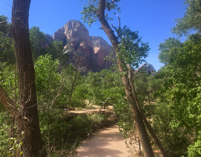
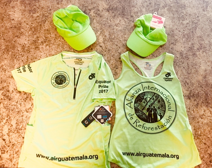
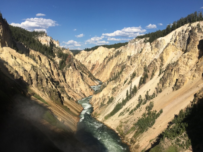
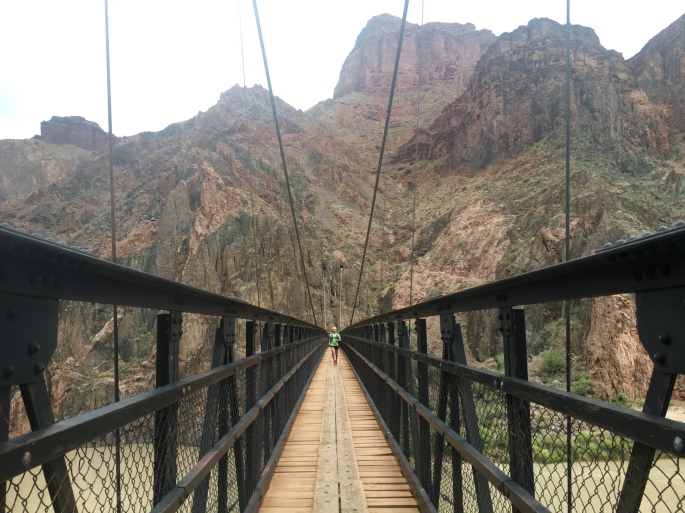
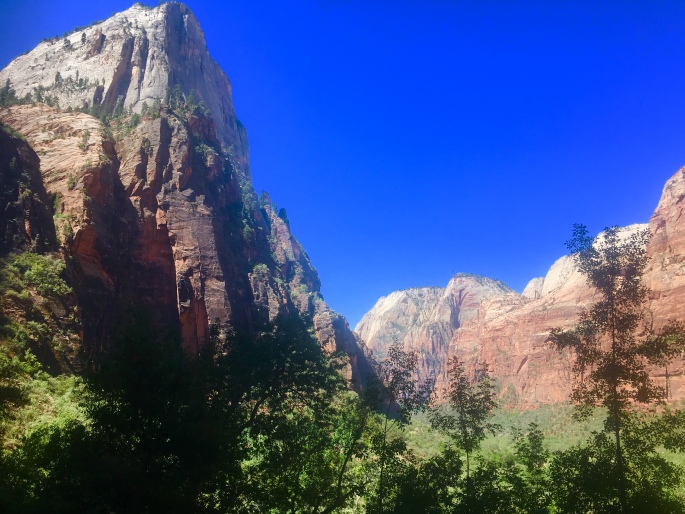
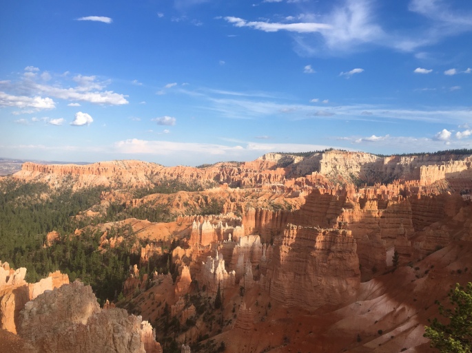
The AIR Adventures team is on the road again this summer, for our annual tour of national and state parks! This time, the theme is canyons, as we’ll be visiting the corners of Utah and Arizona where some of our country’s most popular canyon parks, including Bryce, Zion, and of course, the Big Ditch (aka Grand Canyon). Taken together, these three parks make up part of the Grand Staircase – a vast region made up of different plateaus canvassing millions of acres across Colorado, Utah, and Arizona.

Our first stop was the uppermost ‘top’ step of the staircase in Southwest Utah, where Bryce Canyon is located. The park is by no means the largest – spanning just over 35,000 acres – but it certainly packs a strong visual punch in that circumscribed space. Specifically, Bryce is known for its ‘hoodoos’ – rock formations that have been shaped and twisted by erosion over time into fantastical and bizarre sculptures (insert some overused wordplay joke about ‘Hoodoo – you do, she do, we do!’ here). Bryce Canyon boasts the largest collection of hoodoos in the world.

We opted to explore this strange landscape on foot, as Bryce has over 65 miles of trails winding throughout. Our first run took us on a loop around ‘Fairyland,’ where the trail started us on a series of switchbacks that zigged and zagged over a mile down into the Bryce amphitheater, before turning into a rollercoaster of twists and turns that wound its way through some of the most eye-popping collection of wind- and sand-chiseled rocks in all manner of strange shapes and sizes. It was easy to see how this section of the park earned its name, as we could easily imagine the rocks to be some petrified remnants of magical flora and fauna. All-in-all, the run totalled about 8 miles from Sunrise Point, with just over 1600 feet of elevation gain. Check out our route here!

Adventures in Fairyland.

The next day, we ventured out into the less popular – but equally impressive – wilderness of Bryce Canyon. While most of the park’s 2 million+ annual visitors stick to the hoodoo viewpoints, fewer take the opportunity to explore the backcountry of the park. However, it’s on the less-traveled wilderness trails where one can truly appreciate the ecological splendor and value of Bryce. With the altitude of the park ranging some 2000 feet, it encompasses three distinct climate zones, each home to a wide array of plant and animal life – including mountain lions, pronghorn, and the endangered Utah prairie dog. Our trek into the backcountry took us on an out-and-back route along the Rim Trail from Sunset Point to Bryce Point, where we then took the Under the Rim Trail that descended over 2,000 feet down into the valley floor to Yellow Creek. While we’d originally planned a point-to-point rout that would end at the Whiteman Bench, at Yellow Creek the trail became difficult to find and we opted to play it safe and return the way we came. All-in-all, this route took us nearly 14 miles, with some 2500 feet of elevation gain – all on the return trek, of course! Check out our route here!

Throughout our stay, we also opted for a few shorter, 1-3 mile hikes that also afforded beautiful – and more easily accessible – views. These included the popular hike through the Queen’s Garden, as well as the Bristlecone Loop bear Rainbow Point – one of the highest points in the park.

Interested in going? Definitely take a moment to check out the park’s website and plan your hiking or running routes here. Be aware that especially when hiking the backcountry, the trail conditions and signage are variable, and (as we discovered) the trail may not be as well-maintained as it is near the hoodoos and in the more popular areas of the park. We definitely recommend downloading a GPS map that allows you to track your location, to avoid getting lost in the backcountry. Just as important: be aware that during the summer months, it gets *hot* – and quick! Start your hikes or runs early in the day, and bring plenty of water to avoid dehydration.


Kicking off 2018 with an epic race schedule – for a cause

Happy New Year, adventurers! We hope you enjoyed a wonderful holiday break, with lots of great quality time with family, minimal travel delays and holiday stress-induced meltdowns, and copious amounts of just the right amount of heavily spiked eggnog.

We at AIR Adventures are especially excited to kick off 2018, as we have a great series of races lined up for this year. While we’re thrilled to be able to compete in these events, we’re even more excited to announce that we’ll be doing so to raise funds for our sister organization and namesake, the Alliance for International Reforestation! We’ll be starting off with some of the best-known – and toughest – races the west coast has to offer, including:

  • The Sean O-Brien 100K on February 3. Taking place in the rugged Santa Monica mountains, this race traverses 62 miles of rocky single track and fire roads with over 16,000 feet of elevation gain. It’s also one of a handful of Golden Ticket races for the prestigious Western States Endurance Run.
  • The American River 50 on April 7. An internationally known – and highly competitive – 50 miler that winds along the American River in NorCal, before kicking up a challenging climb to the finish.
AIRtshirts
The AIR Adventures team will be representing the Alliance for International Reforestation at all events this year. Thanks to Champion System and Headsweats for the great gear.

We invite you all to follow along as we provide updates on our training – along with race reports – throughout the next several months. And of course, we also invite you to donate to the Alliance for International Reforestation here. We encourage you to match our race distance with a dollar per mile donation! So 62 miles = $62, or 50 miles = $50…you get the idea. 🙂

Thanks as always – and stay tuned for more updates!

Taking in a composition in red: Arches NP

From the high mountain wilderness of northern Wyoming and Montana we continued our journey south, to explore the desert canyons and mesas of Utah.

Since our visit to the Grand Canyon on our cross country trip two years ago, we’ve always wanted to revisit and spend a bit more time in this region – specifically the renowned ‘Grand Circle’ of national parks that includes Grand Canyon, Capitol Reef, Bryce Canyon, Arches, and Zion.

With limited time, we focused our trip on these latter two parks, with Arches NP being our first stop.

Located just outside Moab in southwest Utah, Arches is an ethereal composition in vibrant red sandstone of grandiose towers, impossibly balanced rocks, and the world’s largest concentration of natural arches. (It’s also by far the most phallic of the national parks. I mean just look at the cover photo).

With only a day to explore the park’s 76,519 acres, we decided the best way to do so would be by bike. We started out at the trailhead of a multi-use path just south of Moab, which took us straight to the park entrance. From here, the road kicked up and climbed a little over 1,000 feet – up to a vista point that afforded panoramic views of many of the giant phalluses amazing rock formations for which the park is famed.

FullSizeRender
Balanced Rock. 3,600 tons of sandstone that could topple at any moment, but for now is standing strong for your Instagramming pleasure.

The road that winds through Arches is essentially an out-and-back route totaling a little over 45 miles. Along the way there are many offshoots that take you past the more well-known arches and formations, including Balanced Rock, the Windows, and Delicate Arch – to name a few.

ArchesNP bike
Arches NP by bike. Super hot fun in the desert sun. 

As the day heated up quickly, we did our best to conserve our energy and not go *too* hard on the bike. Of course, there may have been one or two occasions where we picked up the pace to have a bit of fun – and *maybe* took a couple of Strava CRs and QOMs in the process. 🙂

Check out our route here!

Interested in going? Check out the Arches NP website here, with info to help plan your visit. If you’re intending to do a longer bike ride like we did – or spend any extended amount of time there on a hike, run, etc., be sure to:

1) Go early. It gets hot quickly, and the mid-afternoon heat and sun can make your day much less pleasant than it should be.

2) Take plenty of water with you (Why? See point 1 above. It’s the desert. It gets hot and stays hot). If you need to refill your water bottles, there are fountains at both the Visitor’s Center as well as Devil’s Garden (the turn-around point of the out-and-back route).

Fee? Yes – $25. Pets? Yes – but not on trails. Bikes? Yes – on the road.

Stay tuned for our next adventures! We hope your summer was equally adventurous, exploring new trails and beautiful parks. Tell us all about it in the comments below!


Getting lost in the mountains of Grand Teton National Park.

Our next stop – Grand Teton National Park – was a short drive south from Yellowstone on the John D. Rockefeller Memorial Parkway. As Grand Teton borders Yellowstone on the south, vacationers often combine visits to both parks.

(Fun fact: Early French explorers named this mountain range; being overcome with awe at the majesty and scale of the peaks, they were of course reminded of breasts. ‘Grand Tetons’ literally translates to ‘big boobs’).

While a much smaller than its northerly neighbor, Yellowstone, the scenery of Grand Tetons is no less stunning. The park is named for the mountains that form most of its 309,944 acres. As the youngest mountains in the Rocky Mountain Range, the Grand Tetons are also some of the highest, with Grand Teton Peak (the largest boob) soaring to a height of 13,000 feet above the lakes at its base.

As with Yellowstone, we opted to explore Grand Teton by foot and by bike. Our first day took us on a 60 mile ride from Colter Bay through the Snake River Valley, where we were afforded unobstructed views of the mountains the entire way.

IMG_0469
Um, yeah, so this was pretty much our view for the entire bike ride. Tough to deal with, but somehow we managed.

At the Jenny Lake Visitor Center, we were happy to discover a 2-way bike trail that paralleled the main valley road for several miles. The trail – the Grand Teton Multi-Use Pathway – took us ~ 8 miles to the town of Moose, where we opted to turn back. However, the trail – which was one of the best maintained we’ve ever ridden – extended another 12 miles to the town of Jackson. If we’d had more time (and not rushing due to family dinner obligations) we would have loved to take it! All in all, the ride offered a beautiful stretch of gently rolling terrain with epic mountain views – and a nice reprieve from the significant climbing from previous days. On the way back, we picked up the pace quite a bit, snagging a Strava course record (or two) in the process.

Check out our bike route here!

The following day we took to the trails, eager to explore the mountains. We started from the Jenny Lake Trailhead near the Visitor’s Center, and took the Jenny Lake Trail up to Inspiration Point, before doubling back and then turning on Cascade Canyon Trail and following that along a swiftly rushing creek up to Lake Solitude. Along the way, we were fortunate to catch a glimpse of a mother black bear and her cub, happily munching away on huckleberries on the side of the trail!

IMG_0480
Best shot we could get of Mama (lower right) & Baby Bear from the super-safe distance we were keeping.

We were very careful in passing them both at a safe distance – and we’re glad we remembered our bear spray. However, both mother and baby seemed 1,000x more interested in their berry breakfast than us, and we happily wished them a good day before continuing on.

IMG_0500
The trail was technical in some places, but for the most part very runnable.

All in all, the trail took us up some 8 miles and roughly 2,500 feet before ending at a snow-covered valley with the ice-filled Lake Solitude at the center – a far cry from the sweltering, 90+ degree valley floor where we had started less than 2 hours earlier.

IMG_0504
The views on the way to Lake Solitude were beautiful.

We stopped to enjoy the views – and a quick bite to eat – before turning back. On the way down, we opted to soak our legs in the mountain creek – which felt so so good on our tired muscles!

Check out our run/hike route here!

IMG_0509
The view at Lake Solitude. Why we do what we do.

Throughout our stay, we were struck by the difference in environment stewardship (or lack thereof) demonstrated by the companies that managed the lodging/dining at Grand Teton vs. Yellowstone. In Yellowstone, they have all but eliminated plastic bags and styrofoam from the park, and Xanterra (the company that constructed and manages the accommodations there) prides itself on its use of environmentally responsible materials – from beetle-killed pine in the construction of its lodges, to compostable food containers. In Grand Teton, in contrast, the Grand Tetons Lodging Company offers plastic bags and styrofoam at all of its general stores, dining, and hotels, and there is a notable lack of designated recycling or compost containers – all of which seem antithetical to the purpose and mission of the National Park System. We invite the readers of this blog to write the Grand Tetons Lodging Company (www.gtlc.com) and ask them to commit to greater environmental stewardship in their management, including the elimination of styrofoam and plastic bags from their facilities, and the provision of more recycling receptacles.

Interested in visiting the Grand Teton NP? While we enjoyed our time there, we personally will not be visiting overnight again until the GTLC cleans up its act and commits to a greater standard of environmental responsibility. We encourage you to do the same. That said, you can still visit the park for a day hike or bike ride, without patronizing GTLC facilities. Feel free to check out the run and bike ride routes we did, or check the park website for other suggestions.

Fee? Yes – $30 per vehicle. Annual National Park Passes also accepted. Dogs? Yes – on leashes and in parking areas and along roads. Dogs and other pets are not permitted on trails in any national park. MTB? Yes – on designated trails.

Next stop: Utah – Arches and Zion NP!

Yellowstone: Because what could be more epic than a park on top of a supervolcano.

Following our visit to Craters of the Moon in Idaho, we turned to the northeast, making our way towards the wilderness and famed national parks of northern Wyoming. Our first stop was none other than the flagship park of the National Park Service: the iconic Yellowstone.

Apart from its distinction as the first national park, Yellowstone is also a geologist nerd’s delight: It’s essentially 2.2 million acres atop an ancient supervolcano. Everything in the park – from the rivers and lakes, to the flora and fauna – is in turn affected by the volcanic forces at work. Within the 30 by 45 mile caldera are some of the most impressive geysers and hot springs in the world, including the emblematic Old Faithful and Grand Prismatic Springs, along with lesser known (but equally awesome) features like Dragon’s Breath, Artists Paintpots, and others.

IMG_0605
Yellowstone gets its name from the colored rock surrounding the Yellowstone River, which winds its way throughout the park.

(Important note: When exploring the park’s geysers and hot springs, stick to the boardwalks. The surrounding area is not only fragile, but surrounded by boiling sulfuric acid; you will die a horrible death if you jump in. 😊 )

IMG_0604
These helpful signs found throughout the park show the impending doom that awaits if you step off the boardwalk. You will get hurt while onlookers point and laugh or walk away indifferently.

We spent a total of 4 days in Yellowstone, which we agreed was still not enough time to fully take in and appreciate this massive park. That said, we tried our best to explore as much of it as we could by foot and by bike.

One of our favorite runs/hikes took us to the summit of Mt. Washburn and back down. We started at the trailhead on Dunraven Pass, just off Grand Loop Road. From there, we climbed roughly ~1,500 feet over 3.5 miles to the summit. Along the way, we were afforded sweeping views of the surrounding meadows and countryside, awash in varying shades of lavender, rose, and yellow wildflower blooms.

Near the summit we were happily greeted by a small herd of bighorn sheep! They seemed unafraid of humans, and we did our best to give them sufficient space as we continued to make our way to the summit.

Check out our route up Mt. Washburn here!

IMG_0606
Bighorn sheep silently judging our mountain running skills near the summit of Mount Washburn.

(Another important note: Yellowstone provides a refuge to several species of wildlife; apart from bighorn sheep, it’s also home to buffalo, elk, moose, grizzly and black bears, wolves, and others. If you encounter any wild animal in the park, please be respectful of them and give them space. The park offers guidelines of 100 yards for non-carnivorous species like buffalo and elk, and 200 yards for carnivorous species like bear and wolves. Additionally, it’s a good idea to carry – and know how to use! – bear spray when running, hiking, or biking in Yellowstone or other parks in the region. While bears are not generally aggressive unless provoked, it’s best to be prepared).

The following day, we opted for a bike ride that took us on a 68 mile loop from Canyon Village clockwise to Norris, through Mammoth Hot Springs to Tower, and back up Mt. Washburn before descending back into Canyon. While the ride was challenging – with nearly 6,000 feet of climbing – it was also one of the best ways to experience the the park. We were able to see so much that we otherwise would have missed in the car – including a big bull buffalo rolling in the dust on the side of the road (!), just barely hidden by a small pine grove, or a pair of marmot chasing each other over and around fallen trees.

On our ride, we made another ascent up Mt. Washburn, this time starting from the northern side at the Tower-Roosevelt junction, and making our way up 2,300+ feet over ~10 miles to the summit. The climb offered us breathtaking (quite literally) views of the valley below that we would not have enjoyed or appreciated as much if we had been speeding by in our little Toyota.

IMG_0607
Our bike ride took us through some of the most beautiful – and less traveled – areas of Yellowstone.

Check out our bike route here! (FYI, if you opt to do this route, Mammoth offers a nice halfway(-ish) point for refilling your water bottles).

Before closing out this entry on Yellowstone, we owe a shoutout to Xanterra, the company that manages much of the lodging and dining throughout Yellowstone. They make a concerted effort to prioritize environmental stewardship in everything they do: from building their lodges with beetle-killed pine, to eliminating plastic and styrofoam from both lodging and restaurants. We mention this, because this was in marked contrast to the environmental *irresponsibility* we observed in the dining, general stores, and lodging at Grand Tetons, our next stop.

So our final tally for Yellowstone: 68 miles biked; 26 miles run/hiked; hundreds of buffalo, 10 bighorn sheep, 6 elk, 3 moose, 2 pika, 2 marmot, and 1 bear (grizzly!) sighted.

Interested in going? With ideal weather conditions, late spring and summer are the most popular times to visit Yellowstone. If you’re planning to visit during the months of April – August, be sure to book your lodging/camping reservations months ahead of time.

Fee? Yes – $30 per vehicle for a day pass; national park annual pass also accepted.

Dogs and other pets? Yes, but not on trails. MTB? Yes – on designated trails. Check signs!

Next stop: Grand Tetons!

Exploring the Martian landscape of Craters of the Moon!

Following an all-too-brief stay in Tahoe, the AIR Adventures team headed east, to Idaho, and a pit stop at Craters of the Moon National Monument.

Located just north of the Snake River Plain in Central Idaho, the wonderfully bizarre landscape of this park seems to bubble up from the surrounding plains like some strange brew from an underground cauldron. Indeed, this descriptor is not far from the truth, as the park’s myriad of craters, fissures, and fossilized lava flows that comprise some 750,000 acres owe their existence to the region’s intense seismic activity and violent volcanic past. The most recent eruption occurred only 2,000 (!) years ago.

We opted to explore this strange and somewhat unsettling landscape by foot, as mountain bikes are not permitted on the trails. Additionally, there are a few areas where you have the option to explore caves formed by ancient lava tubes, and which are only accessible by foot (hint: bring a headlamp!).


Our day hike took us from the very top of the Inferno Cone – which at 6181 ft afforded beautiful panoramic views of the entire valley – to the caldera of the immense North Crater, and finally down to the subterranean maze of the Buffalo Caves. Along the way we encountered people of all ages and walks of life enjoying the wonders of the park, including the largest group of Boy Scouts we’ve ever seen. We have no idea how the Scout Masters kept them all accounted for.

Check out our route here!

Apart from being an ideal destination for losing a Boy Scout, Craters of the Moon also is an important ecological site that sustains a diversity of plant and animal life – including six species of bats that make their home in the lava tubes.

 Interested in going? Check out the park’s website here for information on hikes and other activities inside the park. One important note: With the dark volcanic rock and ash, it can get particularly hot during summer months, so try to plan your visit early in the day.

Fee? Yes – $15 per vehicle. National Park Annual Pass also accepted. Pets? In the campground, park lot, and on paved roads. Not on trails. MTB? No.

Next stop: Yellowstone and the Grand Tetons!

Kicking off our tour of parks, with a visit to Tahoe!


This week, the AIR Adventures team kicked off our tour of national and state parks, which will take us through some of the most beautiful landscapes in the American West!

We started things off with a trip to Lake Tahoe, which some have heralded as “the best lake in America.”

Situated on the border of California and Nevada, Lake Tahoe is the largest alpine lake in North America, and the second deepest after Crater Lake in Oregon. The majority of the lake’s watershed is protected land, with several state parks including Sand Harbor; Sugar Pine Point; Spooner Lake; and of course the eponymous Lake Tahoe State Park.

The area is popular year-round – offering a myriad of lakeside activities in the summer, and skiing or snowboarding in the winter. Apart from being an Instagram-perfect vacation destination, though, Lake Tahoe also provides important ecological benefits as a watershed. Additionally, it’s home to numerous protected or endangered species, including the bald eagle and kokanee salmon, as well as rare plant species like the Lake Tahoe watercress.

On our visit, we took advantage of the beautiful blue-sky July weather to explore the region by bike and by foot. Our first venture took us on a 70+ mile bike ride around the entire lake, which included 4,000+ feet of climbing over a mix of long, gradual mountain inclines  and gentle rollers.

IMG_0355
The area has several miles of bike trails, taking you along the outskirts of the lake and through rolling countryside.

Throughout the ride, we were afforded panoramic vistas of the lake and surrounding mountains, which were surprisingly still snow-capped in late July owing to the record snowfall the region received this past winter. The views were only somewhat marred by the seemingly endless traffic in both directions (FYI, if you’re not already aware, you could say that Lake Tahoe is *somewhat* of a popular tourist destination. On the weekend we were there, it seemed like everyone within a 2,000 mile radius also had the same idea to visit. It was crowded). However, even with the bumper-to-bumper traffic, cars were generally respectful, and gave us plenty of room to pass.

Check out our ride here!

The next day, we opted to avoid dealing with traffic and  ventured out for a run along the trails of Spooner Lake State Park. This Nevada park is about 8 miles to the east of Lake Tahoe, and is home to two  equally picturesque lakes of its own: Spooner and Marlette. Our run took us point-to-point from one lake to the other, and back along the Marlette Lake Trail. The route climbed over 1,600 feet through rustling alpine groves and  high mountain meadows – with epic mountain views the entire way.

IMG_0367
Exploring the Marlene Lake trail, on a brilliant late summer afternoon.

Check out our route here!

Interested in going? Be advised that Lake Tahoe and surrounding areas are popular year-round, and can be particularly crowded on weekends and holidays. Plan in advance and make your reservations early. If you’re looking to do a hike or trip to the beach, you should also arrive early in the morning, as parking fills up quickly. (On our bike ride, we observed no less than 4 rather heated arguments over parking. Don’t be one of those guys – plan in advance.)

As for the state parks in the area: they will likely require a fee of $6 – $10. Most are dog and mountain-bike friendly, but be sure to check signs beforehand.

Finally, it’s important to note that despite being a beloved travel destination, Lake Tahoe is under threat due to development and associated pollution. Studies estimate that the clarity of the lake has decreased substantially due to pollution from stormwater runoff associated with construction. Pollution of the lake in turn affects species that depend upon it for survival, including those found in the Truckee River fed by the lake. That said, efforts by local environmental groups like Keep Tahoe Blue have made substantial gains in protecting and restoring the lake and surrounding areas.

Interested in supporting global conservation efforts? Then check out the website of our sister organization, the Alliance for International Reforestation, here!

Next stop: Craters of the Moon National Monument!